Sunday, July 26, 2015

Injured and Happy.

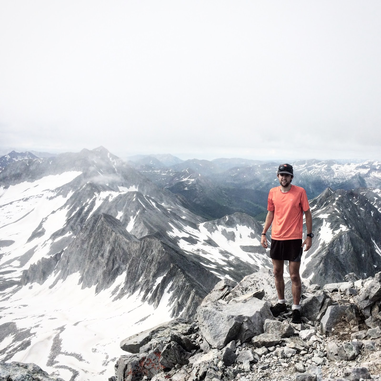
Sunday morning I woke up too late to join some RMR for a new 31 mile rendition of the classic High Lonesome Loop. As such, I pedaled up to Chautauqua as I all too often do after mulling over route choices. I wanted to do stay with sufferfest theme so I settled on going for a Flatiron Quartet plus some bonus scrambles of Challenger and the two dihedrals in the Amphitheater. I somewhat awkwardly soloed around the Rocky Mountain Rescue team practicing saving people on the 2nd -- I chatted with them on top as I had to wait for someone to jumar (I think that) up the fixed line on the West Face downclimb. They were pleasantly positive if not all together encouraging in my rope-less manner of ascent, I guess some other Minions are on the team. Anyways, running down to the 1st I landed with my ankle completely sideways and heard a few pops. Crap. I limped back down to my bike and by the time I was home my ankle bones were painfully enveloped in a swollen and squishy glob.

I used crutches the rest of the day. I tried going for a walk on Monday, but barely made it out my front door before the pain overwhelmed me. On Tuesday I woke feeling noticeably imrpoved but assuredly incapable of running. Despite drooling rain clouds hovering over Boulder I resigned to my bicycle to at the very least get some fresh air. In my incredibly cool keen sandals, running shorts and a U-lock rattling around on my handlebars I was lacking in any hip cycling kit. When I reached the end of Boulder Creek I felt fantastic so I finished the ride with a loop of Fourmile-Poorman-Sunshine. In short, I had a great time but arrived home with a much greater thirst for riding than when I left a short hour beforehand.

I immediately sent out a message to Justin Simoni (if you don't know who he is, please click and read; you're mind will explode), he gave me some route beta on getting up the I-70 corridor to Mt Evans. It wasn't so much of where it is so much as what roads are safe to bike on. I thought I would be able to get all the way up the paved road to summit Mt Evans at 14,000ft+, but I started an apparent hour too late with far too little biking fitness. I turned around about 13 miles but 4,000ft beneath the summit. It was cool though, and really encouraging. Its similar to driving up, but the moments last forever, a cool view lasts 30 minutes, a boring stretch could be 2 hours. You're actively engaged in every moment, not sitting inside of cage passively rolling along. Everything just feels more real, if that makes sense. This was by far the biggest ride of my life at 108 miles, 10,900ft of gain and 7h47m.
Clouds were building in the West, with all the lightning accidents (and my lack of fitness) I was easily persuaded to head home.
Talking to the Long Ranger upon my return he gave me quote that I resonated with, "when in doubt, go slower". Its a weird quote that is not something deeply inspirational, but rather something that should be blatantly obvious but is usually stamped into silence. Looking at the Ranger's rides on Strava, his elapsed times are massive. He's not racing to and from every destination per se (he can still get to movin' if he pleases though), he's out enjoying things. Of course, this is my interpretation from what I've seen; he's a fast dude too, but I think he and everyone would agree that it is near infinite endurance which separates him from others.
Its all about enjoying the ride.
After some recovery miles, I was ready for a big adventure this weekend. My friend Matt -- but we call him Dragon -- is staying in Silverthorne this summer, which is just on the outer edge of my bikeable radius at 92 miles from Boulder. Of course, there is that pesky Continental Divide which is unavoidable. I spent a long time studying maps, Justin's Strava (he's seriously the best source possible for the this sort of thing), and the Strava Heatmap. When you know the route, its pretty simple, but I can imagine lots of erronious navigation bonus miles for someone who hadn't studied the map. The plan was set, I would ride to Lookout Mountain in Golden and zig-zag across (and one white-knuckle section actually on) I-70 until I could bop over Loveland Pass and descend bikepaths to Silverthorne where a shower and bed awaited me. With all my inspiration from Justin, this was likely the factor which separated the hardened mountain-man from the more reserved cyclist dipping his toe in the water.
The westbound route in all of its glory.
I left the house at 4:30AM Saturday morning with two bottles of Tailwind, numerous Chinese rice-crispy thingies (very cheap and 220cal each!) and a small pack of clothes and charging cables for my watch and phone. I almost forgot my Gore-Tex windbreaker, but thankfully pulled a quick U-turn a half mile out. I received a merciful tailwind on the rolling terrain to Lookout Mountain in Golden and found myself on top of the surprisingly cool mountain (where Buffalo Bill is buried no less). The view looks out between two mesas to downtown Denver beyond, which at sunrise was deserving of a photo that I didn't take. Oops. From there it is a very, very long grind to Loveland Pass. I stopped in Georgetown and picked up the ultimate pick-me-up of a vanilla coke and a bag of chips. Despite being pinned down in a low gear puttering along, the bikepaths out of Georgetown were amazingly tucked quietly into the forest but still deceptively close to I-70. The pass itself was easier than I expected; I'm reasonably acclimated to high altitude at this point and though it gains quite a bit of elevation, it wasn't much different than what I had been doing for the last few hours aside from being a bit more relentless at the gradient. After 75 miles of climbing 11,000ft, the descent into Summit County was arguably my hardest earned ever, and I grinned the whole way down. I found some hidden reserve of legs on the flat roads and found myself at Dragon's house eating a burrito before I knew it!
The out-of-state tourists' minds melt when you say you started in Boulder. In-staters roll their eyes and say, "You would be from Boulder". Its a problem.
I woke at 4AM (again) Sunday, but had to linger around while I charged my phone which I apparently didn't plug in all the way the night before. Google Maps can be an indispensable aid I've quickly found, and I would not be running out of battery. The predawn air at 9,000ft dipped down to the low 40's (as I should have known) so I bundled up heading up Loveland Pass but my fingers and toes were left to freeze in the cutting wind. After the opening 3,500ft of climbing I had a long descent to Idaho Springs, so I savored a small patch of sunlight on top of the pass, regaining feeling in my feet. The miles flew by heading down, stretches that seemed relatively flat yesterday were now obviously a decline (or incline, depending on one's heading). Per my highly accomplished cycling uncle's advice I ascended "Oh My God" Road into Virginia Canyon from Idaho Springs for a "scenic" route home. The thing starts off as a wall, but eases into a moderate grade on startling smooth dirt -- smoother than most of the asphalt I was on! Upon entering the casino town of Black Hawk, I was repugnant with the towering citadel of vice smack dab in the middle of an otherwise wonderful area. The remaining rolling terrain along Highway 119 to Nederland hit pretty hard with my body feeling drained with accumulated fatigue. Its net downhill, but the constant little hills were bringing me to a halt each time. In Rollinsville, I spied Devil's Thumb on the continental divide and my mind was refreshed by the familiar terrain (and perhaps a bit upset I wasn't up there on my good ol' feet). I finished off my water and my final candybar (cheaper, tastier and more calories than most sports bars) and descended hard to Nederland then happily zipped down Boulder Canyon with even more extra effort to outrace the rainstorms.
Enjoying some long awaited sunshine on round 2 of Loveland Pass.
The rides wound up being 95mi/11,000ft/7:16 westbound and 97mi/8,700ft/6:50 eastbound. So, while my ankle slowly regains strength, I'm perfectly satisfied pushing my bike around the mountains. There is simply so much stuff that I've either never bothered to inspect or have unknowingly blown past in a car. Looking closely, there is fantastic stuff all over the place -- I mean, its Colorado for goodness sake! This weekend pooped me pretty well (even though I just missed the century mark both days, argh!), but hopefully I can get back out there with a day or two of rest. I'd love to make a go at Trail Ridge Road in Rocky Mountain National Park, I'm sure I could wow a tourist into some free food -- or make someone say "you are from Boulder", to which I would be proud.

Saturday, July 18, 2015

July 5 - July 18

7/5, Sunday - Peak 1 (12,805'), Tenmile Pk (12,933'), Peak 3 (12,676'), Peak 4 (12,866') - 11 miles, 4000', 3:32
With Jack's ankle woes I was left to our planned traverse of the Tenmile Range in Frisco on my lonesome. Combined with the preceding night's 4th of July celebrations and a grim weather outlook, my expectations were low. I got up Peak 1 in ~1:30, pretty casual; the travesrse in the distance looked long, but I started my way to Tenmile Pk (or Peak 2, I highly resent whomever gave such vanilla names to these proud peaks). The ridge from Tenmile to Peak 4, including Peak 3 is by far the most exciting of the traverse, unless your Peter Bakwin doing actually the full range. I tried staying on the narrow spine of the ridge the whole time, but I would occasionally reach a 5th class overhaning downclimb on questionable rock, at which time I would easily skirt around the sides. Really, the whole traverse can be kept easily at 3rd class if you go just below the 20ft wall of rock on the top. The ridge to Peak 4 was a true and sustained class 3 scramble and by far the best of the day. Peaks 5-10 are all tundra/talus and I was feeling especially sluggish so I glissaded down to a trail I spotted from the peak and took a mellow forest road back to Frisco to meet Jack for the impending conquest of 4th of July traffic.
I opted out of downclimbing this gendarme and instead back tracked and skirted around the right side.
Some steep exposure 4,000ft below to the interstate from the Peak 3 - Peak 4 connecting ridge.
7/6, Monday - Green Mtn - 9 miles, 3000', 1:32
A rainy group run. I ran every step from home until the final stone steps -- I think I could have run continuously the whole thing today, but we always throw in the towel and hike the last 100ft together. After getting a ride to the pub I still had to run 1 mile home with a BLT sandwich, a beer and some fries in my stomach, yech!

7/7, Tuesday - Green Mtn, Chase the Sun, 1st Pinnacle - 6 miles, 2900', 1:44
From Chat I jogged easy up the backside for a mellow 45min ascent. I descended down to the west face of Chase the Sun and took its arete around to North where I could descend right to the 1st Pinnacle. Some tribe of middle-school age kids saw me scrambling up the last pitch and told me I was "savage". I suppose its a compliment, but I was most interested in how "savage" became a descriptor kids used.

7/8, Wednesday - Longs Peak (14,255') - 13 miles, 5300', 5:15
Fun day. Started early at 4:45AM straining to see the trail sans headlamp. I ran until about halfway through Jim's Grove at which point I relaxed into a mellow hike. The cloud ceiling receded downward to obscure most of the mountain by the time I hit the Keyhole, so I put on my warm hat and gloves along with rolling my tights down to my ankles (versus the 3/4 roll-up I was previously sporting for the best 3/4 tights weather possible). The ledges were a little wet but with smidgen of extra care they were trivial as usual. The trough was still all snow, but had undergone a great freeze with our recent cold stint so I continued my pursuit onward. One bright side of the otherwise dreadful conditions was that the trough as a snow climb is magnitudes better than the scree-fest it assumes for true summer. The snow began on the Narrows, though with little accumulation; little extra care and its easy as normal. The homestretch posed the biggest dilemma but after a minute of surveillance I found a line up a crack system that went easily. The descent went smoothly, even down-kicking steps in the trough (oddly, very fun). I jogged easy back through Jim Grove to the TH. I was pretty happy with my time considering I felt completely fresh at the finish, never remotely pushed and faced garbage conditions. Looks like I've got my 14er lungs back!
Well, it is called the Narrows.
7/9, Thursday - Off
Driving to Silverton

7/10, Friday - Off
Watching Hardrock.

7/11, Saturday - Kendall Mtn + Silverton - 13 miles, 3800', 2:54
I marched right up the avalanche chute out of town and racked up a quick 3000ft (1,600ft in 1 mile!) before deciding the clouds looked too ominous for me (there had been on/off lightning storms all week). Of course, I turn around, skies look blue; I put on my coat for the rain, it stops, one of those days. A concilation I did a loop around Silverton with some tempo effort. Average pace was 8:20 over 7.5 miles with 750' of climbing at ~9,300' above sea level, so I was very pleased.
A 13er just a few footsteps from town!
Week Totals:
52 miles
19,900'
15:14

Sort of bummed I missed 20,000ft with Longs, Tenmile and three days in the San Juan's. Though it was the result of a fantastic time spectating and semi-crewing at Hardrock. I was able to check out each aid station till mile 48 and see many of the finishes, including Kilian's and Frosty's. What a course it is, absolutely massive! It was probably one of the more inspiring things I've seen in my life.

7/12, Sunday - Hayden Mountain North (13,139') - 7 miles, 3700', 2:45
Kendrick introduced me to Paul Hamilton (2nd to Sage at Speedgoat last year, so he's got some speed) and we ran up to Hayden ridge tagging a 13er before being literally hailed off of the mountain and bushwhacking back to the car.

7/13, Monday - Mt Sopris (12,966') - 13 miles, 4600', 4:03
Having arrived in the dark, I was deprived of the view of Sopris rising 6000 feet out of the town of Carbondale. Though only a 12er, its demeanor is far more suited to a 14er given its size. Don't let the time on this fool you, I hiked a ton, and slowly hiked even more. Even going down I hiked a lot. Nice little recovery jaunt.
Capitol (center) from the summit of Sopris
Thomas Lake, alongside the trail to Mt Sopris
7/14, Tuesday - Capitol Pk (14,131') - 17 miles, 5400', 5:10
The view from Sopris was inspiring so I drove straight to the Capitol Creek TH and made camp for the night. I was running down the ditch trail covered in cattle droppings at 6AM with a magnificent view of Capitol's grim North Face. The long 6 miles approach ended abruptly with steep switchbacks rising from Capitol Lake to the Capitol-Daly saddle. The was a good amount of snow still in the basin, but traversing along the already carved steps was a no-brainer even without any form of traction. After summitting "K2" I stayed generally along the 4th class ridge all the way to the summit rather than taking the standard route that meanders around beneath the ridge, far more exposed to rockfall (common in the Elks)  and far less fun and direct. The scrambling really isn't that bad, but there is some heavy exposure that could make someone not comfortable looking down a thousand feet or two feel pretty squeamish. I can now agree that the "knife edge" is far over-hyped.
High in the air on Capitol. "Satan's Ridge", probably the most technical, dangerous and loose 14er traverse in Colorado, leading to Snomass way in the distance.
7/15, Wednesday - 2 x (1st Flatiron + 2nd Flatiron) - 4 miles, 2900', 2:05
I picked up my new (well, ~110 miles were already on them) running shoes re-soled with climbing rubber today! It was a slow jog to the base of the 1st, but upon starting up I felt an indescribably secure stick with each step I took. Without much effort, I easily made a 17min scramble. Seriously, this rubber makes just about everywhere on the 45 degree slab a great foot-hold. Downclimbing the Freeway I was able to honestly run about 200 vertical feet getting some wide eyes from a few climbers. On the second lap up the 1st I was a bit slower, 18:22; still much faster than my typical ascent. On the 2nd, I downclimbed the Freeway to just below the jump then traversed South and trudged up the Free for All route to the true summit. I finally nailed the line on this one, sticky rubber playing a large part.

7/16, Thursday - Regency, Royal Arch, 5th Flatiron, 4th Flatiron, Challenger, Morning After - 6 miles, 3300', 3:53
Fun day out tagging a bunch of routes in the central flatirons area. After the warmup jog along the Mesa trail I began what would be the theme of the day: messing up routes. I was too far south on the Regency, which was no issue given its such an easy rock. The Royal Arch was one of two exceptions that went very well; though, you have to give a concentrated effort to mess up Royal Arch. I took my now typical route straight up the center of the 5th, then I tried downclimbing to the ledge along the south side. I chose a ledge way too high and ended up doing a couple more 5.4 - 5.5 moves as a result, but it was more of a time suck than anything. On the 4th I took the water groove on the second piece, which was of course filled with water (argh!). I should really just stick with the lines that I can nail on the 5th (keyhole downclimb) and 4th (hand traverse on the second piece). In retrospect I got the third piece's line pretty well. From here started my mini Barkley-esque schwack. Challenger's lower third is still a bit puzzling, particularly 10ft right below the hand-crack, but its just such a cool rock! Last (after much thrashing about in the undergrowth) was Morning After -- or The Needle, or The Thing, depending who's guidebook you're reading. It was 5.4 on the first pitch till you hit the 5.7 overhanging roof. This move took a minute, but once you have all of your holds properly identified, you just pivot on your foot, and just like that you're over it. I tried taking the 5.6 northern variation but opted out midway through, downclimbed and traversed south to the standard 5.4 route up the southern side. The run/hike/curse/scream/scramble back to Royal Arch was a wet lichen covered hell and I was overjoyed to finally join the Royal Arch trail to get back down.

7/17, Friday - AM: Free For All, Atalanta/Kamikaze, Fandango - 3 miles, 2300', 2:22
Despite doubling today, I was keen on taking it easy speed wise, so I hiked everything uphill or flat and gingerly trotted downhills. After working on dialing in my route up the 2nd I putsed around on the south side of the 1st. Firstly, I started off with Atalanta which somehow ended in the finish to either Kamikaze or Zig-Zag. Then, looking for Baker's Way (seriously, how do I never find it!?) I got on Fandango and took a 5.6 variation which took me to the slot variation of the Direct Route.
PM: Dodge Block Tunnel, Chase the Sun, Amphitheater - 3 miles, 1600', 1;35
Easy scrambles with Jack, strictly hiking.
On top of Chase the Sun with behind the 1st (pic by Jack)
7/18, Saturday - Pawnee Buchanan Loop - 27 miles, 7100', 5:50
Nice group effort on the staple loop through the Indian Peaks. Up near the front of the group we maintained a good effort the whole time, but we had about an hour and a half of stoppage time between waiting to regroup and stopping for views a few times (5:50 was running time). I felt reasonably well all things considered. Nice burn in the quads on the last 3500' decent and some definite mental fatigue from long hours lately

Week Totals:
81 miles
33,000ft
30:18

Holy cow, that was monstrous. Looks like 3 summits (all 12,900 or higher) and 17 climbing/scrambling routes! A lot of long slow effort which was key in getting things done.

Sunday, July 5, 2015

June 28 - July 4

6/28, Sunday - The Seal & The Slab - 5 miles, 2700', 2:27
Today was a great easy day, I was strict about keeping my exertion very low even if that meant walking relatively slowly. I started with the Southeast Face of the Seal, which starts off at a stiff 5.4 before easing into a relaxed 5.0-5.2. I was happy I decided to bring rock shoes for the first pitch of crimping and minuscule foot holds. I had to take a harder downclimb along the north side since a roped party was using my preferred route, but the actual west face was a trivial 4th class ramp to the ground. On the Slab I took Diagonal all the way across the length of the rock (which is really far), since it was allegedly "classic". Unfortunately almost the entirety of the arete was a broken shamble of lichen and swarming with red ants, a far cry from noteworthy scramble. The final pinnacle did finish the scramble well, with a few super exposed vertical moves.
A whole new realm of unknown slabs and routes on Bear Pk's eastern aspect. Unfortunately, many require a rope for a rappel.
6/29, Monday - Green Mtn - 6 miles, 2500', 1:22
Somehow hadn't made it up Green in a while. Nice easy run with RMR. Jack and I were able to lay out some fiendish plans for the weekend. Hopefully they work out well!

6/30, Tuesday - Locomotion Lab - 3 miles, 0', 0:45
Last lab session, left it just at that for tomorrow's sake. The cool thing about today was reminding me of how fun it can be just run - flat, straight and slightly up-tempo was surprisingly grand.

7/1, Wednesday - AM: 1st Flatironette, Spy, Green, South Green, 7 miles, 3100', 3:13 - PM: Satellite Boulders + 2nd Flatiron - 3 miles, 1300', 3:00
I felt pretty depleted from the get-go so I resolved to hike everything today. Heading up the trail I ran into Bill and Corey, and joined them for the 1st Flatironette - Spy linkup before I continued up to Green. I was planning on tagging Bear & SoBo, but on the fly decided to explore the Sacred Cliffs route over to South Green. It was an interesting scramble to say the least; mostly characterized by acres of lichen and narrow 20ft notches in the ridge. A very cool summit with views rivaling Bear nonetheless.

In the evening I tacked on to some of Jack's friends to go bouldering. I had never been before -- well, outside that is -- but it was very fun. I was able to get one V2, and was enthralled watching a very-near-successful V10. Afterward we ran into our friend Joe and did an alarmingly quick, yet easy jaunt up the 2nd, I should scramble in sandals more often!

7/2, Thursday - Off

7/3, Friday - Browns Pk (13,523') & Huron Pk (14,003') - 17 miles, 5000', 4:17
Jack and I left our campsite near Missouri Gulch and had a nice 4 miles running along the dirt road before turning up Lulu Gulch. We broke off of the old mining road early and took a nice grassy rib up to Browns Pk's north ridge. I summitted Browns and caught back up to Jack near the top of Huron. He descended from the low point on the Huron-Browns saddle down a nasty gully which eventually gave in to some nice glissading. After thrashing through the trees we were planning on heading up to Missouri/Belford/Oxford on the Nolan's route, but we missed the turn up Missouri's ridge and ended up running nearly to Pear Lake. We were well aware of our mistake early on, but the trail we were on was quite nice and all runnable so we just enjoyed the out and back before dropping the road back down to camp. I was bummed in a big way we didn't get to complete our "Nolan's 4" route though. Oh well.
Jack stomping through one of the numerous creek crossings.


Jack on top of Huron looking over to the trio we had planned for the day.
7/4, Saturday - Mt Belford (14,197') & Mt Oxford (14,153') - 10 miles, 5800', 2:57
We started up powerfully and held a strong pace all the way up to Belford. I was happy to churn out the ~4500ft climb in 1h25m, Jack came in a couple minutes right behind me. We breezed over and back to Oxford then started the descent. Jack had the misfortune of rolling his ankle sort-of badly twice within a 5 minute period so he resigned to a much slower pace so as to not destroy himself even more (he fell and hit his jaw in a boulder field descending Huron too!) while I gave just enough effort to sneak in under 3 hours.

Week Totals:
53 miles
20,400'
17:16

Huh, that week felt a lot harder than the stats reflect! Ah well, it was some good work up high.