Monday, September 4, 2017

Wild Basin Traverse


Labor Day weather was looking phenomenal so I was also assuming that anywhere popular and accessible would be a swarm. Lately, I've been interested in the Middle St. Vrain which comprises a spectacular, overlooked and remote section of LA Freeway which is feeling more and more possible the more I learn about the line. When I found out Jack would need a car shuttle to move his car back to Boulder while he and Kiri ran across RMNP to her cabin in her Grand Lake I realized I had a convenient car shuttle for the Wild Basin Traverse!

Only known to be fully completed by Peter Bakwin, the full Wild Basin Traverse crosses 15 peaks in a 30 mile loop. Wild Basin is also a great destination on a busy weekend as the approaches are rather long and a few obstacles along the Continental Divide prevent easy access. Important for this day was that I would be dropped off at the Sandbeach Lake TH and finish at the Wild Basin ranger station 2 miles up the road where Jack would leave the car!

I slept through my alarm, woke up to a phone call and was picked up minutes later. Again, the weather looked perfect so sunscreen and a shell was all I needed for the day. For my pack I opted for a two-liter bladder over bottles since I wasn't going to be finding any running water and I would need to have more than two soft flasks would provide. I was then able to use upfront storage for food which prompted me to eat a lot more than I normally do. For shoes I wore the S-Lab Wings 8 Soft Ground, they run well, climb well, look rad and the 2017 model can seemingly take a huge beating and stay in fine condition!

Looking east from the slopes of Lookout Mountain
I left the Sandbeach Lake TH at 6:10AM and walk-jogged the trail until Peter's GPS left the trail -- I would heavily rely on this handy file most of the day! Lookout Mountain is actually a cool little pinnacle on the south ridge of Mt Meeker though is utterly dwarfed by every other peak along the route. The summit is marked with a mushroom like tower with expansive views to the enormity of Wild Basin. I didn't waste time lingering here, after a short descent I began the giant 4,000ft climb to Mt Meeker. The final ridge traverse to Mt Meeker is a gem, an exposed knife edge with great secure holds the whole time.

On top of the Lookout Mountain pinnacle

The mushroom cap to Lookout Mountain

The knife edge ridge leading to Mt Meeker. "The Beaver" and Longs Peak on the right.

From Meeker I was excited to make my first trip up "The Beaver" or "Southeast Longs", the opposite side of the Notch from the actual summit. From the Beaver, you could say hello to the crowds on the summit of Longs -- however, the Notch makes it rather difficult to get there. Using Peter's GPS, I identified a chimney that I believed to be Gorrell's, the 5.5 downclimb to reach the bottom of the palisades directly. It went well at first but I hit several dead ends and wasted a bunch of time before finally reaching the talus beneath. My struggles seemed to be well enjoyed by those ascending the standard Clark's Arrow route below -- though some were horrified asking if they had climb up that way (did you even look at the route or map before heading up!?). I wrapped around through the east side of the Notch and took the stepladder scramble to the summit. Longs was predictably crowded so I slapped the summit marker, bombed down the Homestretch (looking around unsuccessfully for my friend Joe who I knew was up there somewhere) and skirted off of the Narrows towards the Longs-Pagoda saddle.

The prominent tower of the Keyboard of the Winds
Getting to Pagoda I was able to get a close-up view of the Keyboard of the Winds; I noticed two climbers on top of Pagoda, when I saw them leave the summit to the West I suspected I would either know them or they would soon be retreating back over the summit, stymied by the complicated west side. I tagged the summit of Pagoda just over 30 minutes after leaving Longs. Getting off of Pagoda to the west is notoriously difficult: the ridge direct goes at a radically exposed 5.7 that I don't wish to solo -- down, no less -- in running shoes. Kyle and I found a line earlier this summer that went a little easier but today I was armed with Peter's 3rd class sneak route! As I began traversing back southeast towards the sneak the two climbers yelled out to me, it was Bill and Dereck just starting a multi-day attempt on the LA Freeway. They weren't exactly sure what line to take but after some trial and error we all found the wonderfully simple downclimb to the ledge that would safely transport us to the Pagoda-Chiefs Head saddle. Motoring away, the last I saw they were just a bit behind me heading to Chiefs Head.

Look really closely and you can see Bill and Dereck following the ledges across to the downclimb off of Pagoda

The Broadway-esque ledge providing easy passage off of Pagoda

Bill and Dereck dwarfed in Pagoda's Southwest face

Looking back into Glacier Gorge from the summit of Chiefs Head

Looking towards Alice (left) and McHenrys (right) from Chiefs Head

Mt Alice is a big mountain, its separation from Chiefs Head consists of a talus descent followed by a long stretch of tundra and then a section of easy but steep hiking to the summit. I felt really tired here so I just put my head down and tried not to ever stop. The summit came soon after, marking just about the halfway point of the traverse after 7 hours. The next peak Tanima is perhaps the most annoying summit to tag as it sits on a peninsula 0.75 mile out from the general line of the divide. The summit is nevertheless worthy as a vantage point to the entire basin.

Tanima (left) offers a long tundra jog between Alice and Isolation (big complicated looking peak in the distance)
Moving from Tanima through the Cleaver to Isolation Peak was new terrain to me. Despite its profile and position, the Cleaver went at an exposed but simple 3rd class. The north ridge of Isolation looked like a great route but certainly requiring some careful route finding on steep 5th class terrain. Instead, I took Peter's advice and took ledge along the west face until a grassy gully opened above me. Although I added a 100ft or so of elevation change, this hiking route was surely faster and way safer than slowly moving up the true north face. Even after regaining the ridge, the summit of Isolation felt like a real slog. It was fun to look west at a new perspective of the Fast Pfiffner Traverse route which climbs the west ridge of Isolation after descending to between Fourth Lake and Fifth Lake from the Alice/Andrew col.

The North Face of Isolation Peak, the west ridge sneak is visible on the right.

Summit of the Cleaver, Tanima behind

The west face of Isolation, Fifth Lake and the East Inlet
Descending Isolation I began to have a pity party and seriously considered bailing to Pipit Lake. The prospect of exploring the Ogalalla - Elk Tooth ridge re-engaged me though, and I found a well of energy that enabled me to actually run a good bit of even the uphill tundra. Ouzel and Ogalalla pass quickly, at 4:30PM, this is actually the earliest in the day I've ever found myself on Ogalalla Peak. By any route, Ogalalla is big day and today I was happy to not be so pressed for time as to not take in the beauty of the cirque of the Middle St. Vrain. These mountains are gentle on the west but fall sheerly to the glacier beneath on the east. The scale is so breathtaking I briefly consider hiking to Buchanan pass to fully experience the area.

Descending Isolation's south ridge and looking towards Ouzel (bump on the left) and Ogalalla (distant high point)

Shoes and tundra

Looking towards Copeland (far left) the Elk Tooth (center, distant) and Ogalalla (right highpoint)
I begin downclimbing the east ridge of Ogalalla towards the Elk Tooth. The rock is in poor quality so I engage bypasses whenever possible rather than traversing each tower. I found in general, the south side of the ridge to be the safer and easier option. Still, care must be taken and I get cliffed out a few times on ledges covered in sand and loose rock. Cautiously, I regain the ridge at the saddle and stay generally along the crest in my final scramble to the summit which seems to be the last pinnacle still basking in the evening light beaming through notch formed by Ouzel and Copeland.

4th class slab leading from Ogalalla to Elk Tooth. Wild Basin to the left (featuring Copeland) and Middle St. Vrain and the Indian Peaks to the right

Same as above but with me

The Elk Tooth rising above Middle St. Vrain

At 6:00PM I am tired and hopeful to get back to Boulder for some dinner. The final two peaks look to be grassy knolls on a map but in reality look quite ominous after 12 hours and 13 other summits. Armed with the entirety of trails in Wild Basin mapped on my watch I decide to descend to the Hutchinson Lakes trail which ends up being a bit more complicated than I had hoped. I skirt through some cliff bands and find the trail to be in obsolescent condition. Nearly impossible to follow without GPS, a cairn only every 400ft and overgrown willows and krumholtz  make travel extremely slow. When I finally reach Pear Lake I know the ranger station is only about 4.5 miles away. Unfortunately, the trail takes me on an eight mile wandering with needless ascents, twists and turn. Exhausted, I resign to my headlamp at Finch Lake and continue pouting along the trail. As darkness fully takes over I somehow find even more motivation to be done and again dig into a well of energy to jog the final miles to the car. In the end, it probably wouldn't have added that much more time to just add on the last two summits.

Copeland standing proud of the Hutchinson Lakes (lack of) trail

Pear Lake

Benighted.
It was a great day! I summitted 13 named peaks in just under 15 hours. I was alone the entire day aside from the crowds on Longs and seeing Bill and Derek on Pagoda. I was most happy to really come to understand the routes which sneak around the dangers and perils of the more unsafe sections of the LA Freeway. Peter also bailed at Elk Tooth the first time he tried to traverse Wild Basin, finishing in almost the exact same time. Hopefully, it doesn't take me that long to return! If I can learn Gorrell's traverse better and having already figured out Pagoda, Isolation and Elk Tooth, I know I'll be able to move much faster on my next go -- whenever that is.

With all of the hype on seemingly a few overly classic and iconic mountains and routes its reassuring to know that a route of this magnitude, remoteness and obscurity is only a short 45 minute drive away. If you want to have an adventure away from the crowds, you need to get far away from a trailhead, on something technical and on something committing -- so basically, Wild Basin.

Summits:

Lookout Mountain - 10,715'
Mt Meeker - 13,911'
The Beaver - 14,060'
Longs Peak - 14,255'
Pagoda Mountain - 13,497'
Chiefs Head Peak - 13,579'
Mt Alice - 13,310'
Tanima Peak - 12,420'
The Cleaver - 12,200'
Isolation Peak - 13,118'
Ouzel Peak - 12,716'
Ogalalla peak - 13,198'
Elk Tooth - 12,848'

Monday, July 17, 2017

Pfiffner Traverse

Last year, Abby and I took on Mark Oveson's "fast" version of the Pfiffner Traverse, almost on a whim. While we completed the first 40 miles of the route, the final 15 miles were in complete darkness. The route is pretty unbelievable, it traverse peaks and basins weaving a glorious line from Milner Pass to Berthoud Pass.

I decided to sleep in my bed in Boulder rather than camp. Mainly, for the quality of sleep and ease of having a good breakfast; plus I enjoy the waking up process that the drive lends. We got held up behind a herd of elk on Trail Ridge road and I found out that the GoPro was out of batteries so I would have to deal with lower quality phone images. Ah well. Jack and Kiri were already at Milner Pass when we pulled in; I was a little stressed on the tardy start time so I pretty much got out of the car and started walking.

It's actually quite a special moment now that I'm not in a rush (Photo: Abby)

If you actually plan on reading this whole thing, I might recommend following along via my Strava (part one, part two) if you don't happen to have been studying this route for the past couple months and aren't sure where any of this stuff is.

The first peak, Mt. Ida has trail the entire way, obviously being the first I felt great, only stopping a couple times for the predictable morning bathroom needs. From Mt Ida to Flattop Mountain there are a handful non-unique grassy summits: Chief Cheley, UN12820, Cracktop, Eleanor (bypassed), Sprague, Knobtop and Ptarmigan point. The Eureka ditch, just south of Sprague was unfortunately dry aside from a few isolated pools. I elected to bring a lifestraw in addition to my bottles so I could comfortably drink out of any and all sources. At about 4 hours in, both of my bottles were empty so I was happy to not have to be picky about my source. Furthermore, I would be able to shed water weight from my pack by only drinking from streams for the next several miles.

Leaving Milner Pass TH (Photo: Abby)

A regal looking Longs Peak on the horizon from the summit of Sprague.

Last year Abby and I found a flowing stream at the Eureka ditch, but here is just vaguely moist dirt. Just below Knobtop.
Flattop mountain was predictably busy with people enjoying the summer alpine. I turned west and headed down the North Inlet trail. Soon thereafter I crossed paths with Abby just above treeline who was running the North Inlet/Tonahutu loop (plus an extra credit tag of Hallet), an often overlooked classic alpine marathon. I continued down the well traveled trail until I turned back uphill on a trail forking south towards a spectacular series of alpine lakes. The first stop was Lake Nokoni, I was feeling hungry and thirsty so I took some time to put down a bunch of food and drink a lot of water. Revitalized I continued to Lake Nanita where the trail fades away. I was moving well here, but the going is inherently slow when you are bushwhacking around a lake. Constant deadfall and stream crossings necessitate a meandering path through the trees. Above the lake, the Ptarmigan towers soar to the sky -- if it wasn't a 10 mile hike in I'm sure there would be classic climbs on each tower.

Heading down the North Inlet switchbacks (Photo: Abby) 
Lake Nokoni Trail
The Ptarmigan Towers
The route past Lake Nanita is a small col on the northwestern shoulder of Andrews Peak. The hike to this point is quite pleasant as the forest is much thinner. The pass through the col just squeaks above treeline and the rocky drainage ahead looks quite snowy. The snow ends up being a nice change of pace, it is well consolidated and offers a rapid descent. The pass on the other side is the saddle between Mt Alice and Andrews Peak, I have to laboriously kick steps up a snowfield to reach the pass but on the bright side, I was able to take a straight line up. Unfortunately, I make a huge mistake atop this fantastic lookout -- I forget to look around! Another magnificent peak lies just to southwest, Aiguille de Fleur, which is similar in shape to the Spearhead but has a flat mesa like summit covered with grass and wildflowers.

Looking towards Isolation from the Andrews col. Andrews peak has a magnificent east face, barely seen on the right.
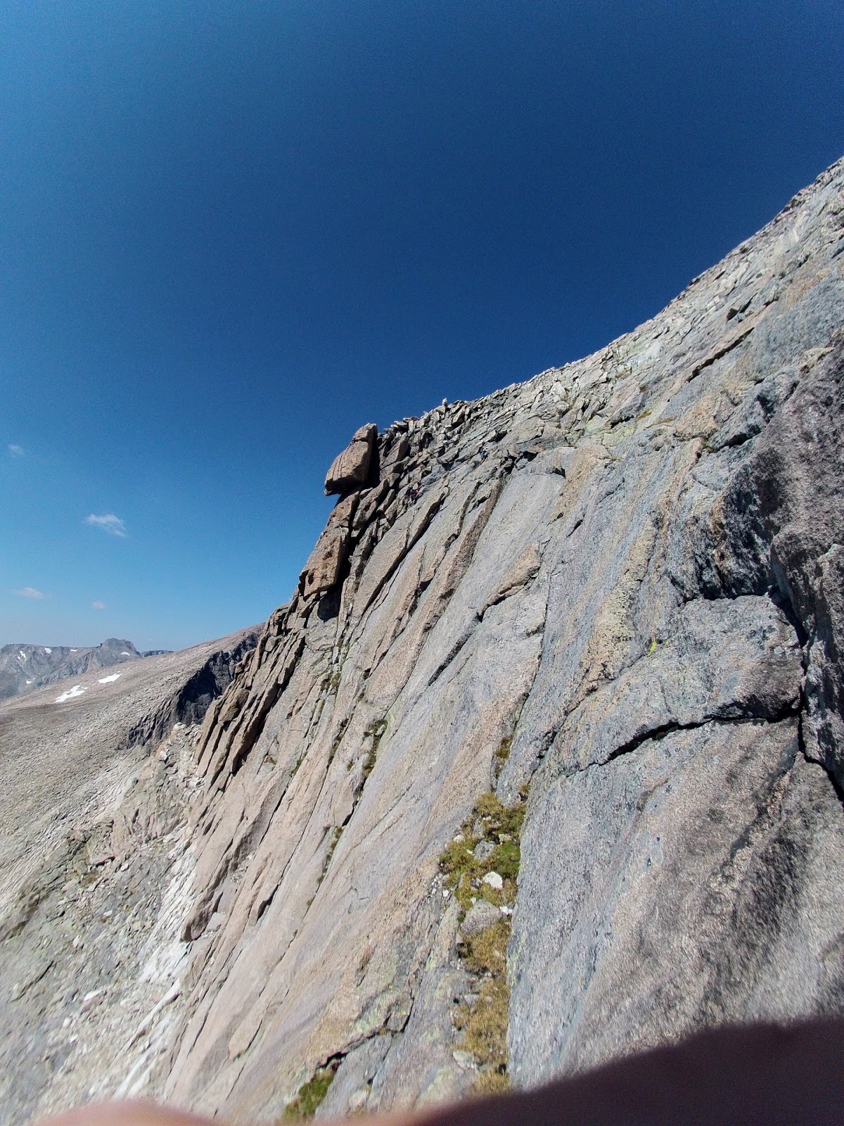
The descent from the Andrews-Alice saddle to the faint East Inlet trail is the nastiest bushwhacking of the route. It is steep and grungy but I manage to pick a line following a game trail for bits and pieces that takes me there in what felt like the most efficient line. The west face of Isolation and the Cleaver loom to east, another wall surely full of great climbing which would be frequented more if it weren't for the approach. Surprisingly, I bump into six people in this remote drainage -- two groups of three. The first was simply hiking to Fifth Lake, a long abut worthy objective; the second allegedly made an attempt at Isolation Peak. Last year, Abby and I (along with Mark in his route) bypassed Isolation by instead traversing along its southwestern slope on loose rock, this year I planned on summitting after reading Lisa Foster's guidebook claiming the ridge went at class 2. The group coming down said it got to be technical climbing, I later found there footprints turning around only 100ft above the lake on a snowfield, about 2,000ft below the summit. The remainder of the route went well at an exposed but obvious and easy class 2. From the summit is a fantastic view of Wild Basin and the west face of Longs Peak which is less seen but equally impressive.

Looking up towards the Cleaver (somewhere in there, not sure where). The boulder in the foreground is where Abby and I waited out a thunderstorm last year!
Ten Lake Park which composes a small portion of the much larger, unexplored and trail-less Paradise Park drainage. Mt Adams (?) in the distance.
The west ridge of Isolation, there is more to go beyond what is seen in this photo, but the notches you encounter are easily navigable.
Embracing the wind on top of Isolation Peak
My remaining traverse along the divide before dropping off, Ouzel (left, dark peak) and Ogalla (grassy high point just left of center).
Looking back towards Andrews Peak (grassy, left of center) and the two passes used to traverse from the North Inlet drainage to the East Inlet drainage.
Although storm clouds began swirling around nearby peaks there was no electrical activity, so I steadily moved along towards a group of three summits, Ouzel, Ogalalla and "Ooh la la!". Both Ouzel and Ogalalla lie just enough away from the direct line to be frustrating but the views from the top of each are worth the extra effort. The evening light cast wonderful light onto the nearby summits of Copeland and Elk Tooth. "Ooh La La!", a satellite peak of Ogalalla forms a mighty cirque around the St. Vrain Glacier, although a walk up from the west, approaching these peaks from the east seems impossible. From the summit, the light upon the central Indian Peaks is breathtaking. The perspective on Lone Eagle Peak and the Mohling Traverse is particularly striking.

Looking back towards Alice, McHenrys, Chiefs Head, Pagoda, Longs, Meeker, Ouzel (left to right) from just beneath Ogalalla's summit
The central Indian Peaks basking in the evening light, one of the best views of the entire traverse! If you know where to look for the Mohling Traverse, it is incredible from this perspective, Iroquois looks very proud.
Looking down the Ooh La La! - Cooper - Martin ridge, Island Lake and subsequently Gourd Lake lay just beyond the grassy slope. 
View from the summit of Ooh La La!, Ogalalla's East Ridge, Chiefs Head (barely!), Pagoda, Longs, Meeker, Copeland, Elk Tooth (looking very proud!)
Last year, Abby and I summited "Ooh La La!" at about 11PM in complete darkness which was semi-terrifying as we really had barely any idea where we were. Thus, the following descent to Gourd Lake was executed by means of the most inefficient, tedious, thickly vegetated route which included short slabby friction downclimbs which often ended with a leap into the willows below. My rush to reach Gourd Lake this year was prompted by this. Armed with experience of where not to go, daylight and a promising GPS track plucked from the interwebs I descended with confidence. Reaching Cooper Pass involves a steep section of loose talus but culminated with a long, steep and unavoidable glissade that warranted some sharp rocks in hand, just in case. Island Lake in the evening light was everything I hoped it would be, the water was calm and vividly reflected the walls above glowing in the sunset. I proceeded with my new route which went perfectly to Gourd Lake. I made it from the summit of "Ooh La La!" to the Gourd Lake trail in 1:10, last year it took 2:45!

A reflecting pool just above Island Lake, it would have been nice to take my time and photos here but I wanted to get every last drop of daylight on this tricky descent!
Looking back at my glissade path, there wasn't really another option!
Having rushed down and not bothered to change my layers from windy evening above treeline to calm air a couple thousand feet lower I paused to remove my wind pants and coat, eat and drink then fire up the headlamp. I now had one hundred percent descent on trail to the Arapaho Pass junction near Monarch Lake where I would meet Jack, Kiri, Kyle and Abby. I make a point to jog which feels better and better as I get lower. It is a deceptively long stretch of trail and I'm thankful to eventually see the light of friends having been essentially alone for the last 17 hours covering 40 miles.

Meanwhile down below... (Photo: Abby)
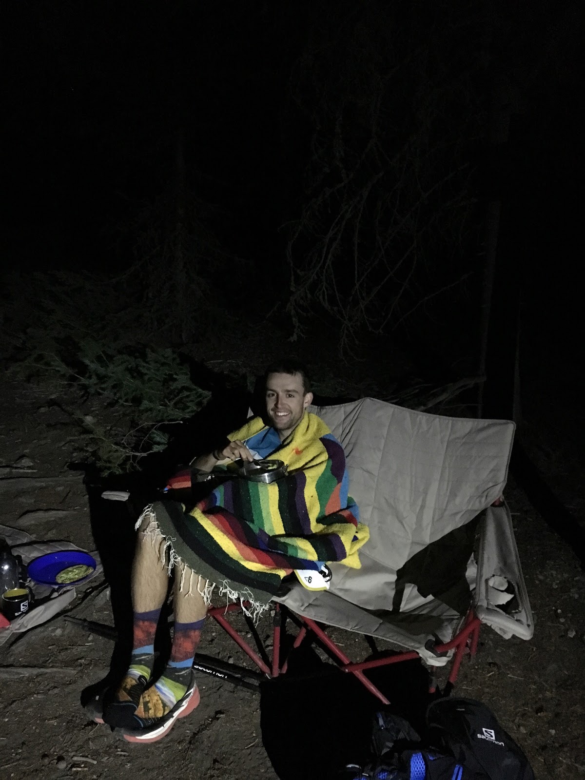
Only Abby and Kiri are at the aid station as Jack and Kyle had rushed out to cell service to check my SPOT. I sit down and begin wolfing down cold soup, I'm in no particular rush to leave, if I were to end right here like Abby and I did last year I would be content, the route is a serious undertaking which is equally matched in the quality of the scenery. Continuing to eat and drink I relish the conversation with Kiri and Abby recounting the spoils of the journey. I eat almost 2 liters of soup along with a couple sliced of avocado bread while they tend to emptying my pack full of empty wrappers and filling it back with food (which weighs a lot more than wrappers). I change into three-quarter tights and a down layer and prepare to leave just as Jack emerges from the trees, happy to see him I stay just a touch longer before saying goodbye at around midnight.

Happily eating Abby's homemade potato and cashew soup! (Photo: Abby)
Back to solitude, I am fully aware of the length of trail between me and Arapaho Pass. The trail is lush, almost overgrown in places. With two liters of soup, a freshly filled pack of food and full bottles my steps move slowly. I follow the tunnel of light before me losing track of time. Feeling sleepy I set a timer for 7 minutes and enjoy a quick nap; I wake alert and refreshed almost in disbelief in how effective the brief sleep was. I repeat my nap tactic 90 minutes later with similar results. The trail continues to steadily move through the forest barely gaining any elevation, meaning must be a steep grind to the pass at the end. At around 4AM, my headlamp flashes, meaning I'm about to run out of battery. I decide to push to treeline which takes another 40 minutes. Knowing first light should appear around 5AM, I take one last lonesome nap in a sheltered nook ensuring I won't be caught above treeline in the dark. I awake to just enough light to move confidently without a headlamp and to see the steep switchbacks ahead. My movement is slow, but eventually I crest the ridge with great views of the jagged ridge stretching from Cherokee to South Arapaho Peak which generally composes the grim finale of the LA Freeway.

The usual night time nap break view. Sidenote: the sense ride is phenomenal!
The sun is welcomed but my effort and loneliness weigh heavily upon me. Staggering up the beginning of Neva's north ridge I doubt my intentions. Staying determined, though breathless, I launch onto the thinning 4th class ridge of Mt Neva barely able to balance. Scared of taking a stupid step off of a cliff I retreat back to safer a ground and take a seat on a rock. I remembered that there is great cell service on this ridge so I call Abby telling her I don't quite feel balanced enough to tackle Neva. After our conversation my retreat seemed as fueled by the effort required to continue as it was by my lack of coordination so I decide to try once more. Moving unbelievably slowly so as to maximize safety, I make my way along the ridge making sure to never get out of breath and potentially lose balance. It takes me actually double the amount of time it took me when I first did the ridge but two hours later I'm on the summit, out of water and staring down the continental divide as it stretches south.

Neva's North Ridge
Berthoud is for the first time visible, though even Rollins Pass alone seems an eternity away. The weight of all my food is useless without a drop of water to be able swallow. Expecting the divide to be a swamp as I've seemingly always found it in the past, today there is no sign of any water. I find a small snowfield below Neva's summit to scoop out of but waiting for it to melt in a bottle is no quick thing. Jasper, the next peak, is only a short 500ft climb a mile and half away but my dehydration and calorie deficit are taking form in severe shortness of breath. The mile and a half to Jasper's summit takes me an hour and half.

I text Abby that I'm done at Rollins Pass. I feel totally satisfied with what Milner Pass to Rollins pass entails. She drives to Rollins Pass while I move painfully slow over UN12660 then down and up Devils Thumb Pass. On the final climb I am forced into a two steps to ten breaths tactic to maintain myself. I thankfully join the High Lonesome trail heading south to where my journey will end. I meet Abby two and a half miles from the pass. In no rush we lay in the grass, she brought me two bottles of water which I easily dispose of along a peanut butter sandwich.

Not a bad place to lounge about. (Photo: Abby)
Abby and I effectively began dating during our Pfiffner attempt last year. Now, happily laying besides one another in the alpine tundra I feel profoundly happy. The remaining traverse feels to be focussed far more on the slog factor and physical challenge than on the quality of the route. They're good peaks, but when the reference is The Park and the Indian Peaks, it is hard to compete. Certainly and validly, this can be interpreted as an excuse to quit, I'll take that. It should also be duly inserted here that what Mark did accomplish from Milner to Berthoud is an incredible accomplishment. What I wanted from this adventure was the splendor that comes from immersion in the wilderness, having accomplished that I felt no regrets with ending the route.

Done. (Photo: Abby)
This is truly a classic route and I'm grateful to be following in Mark's footsteps. I think the Pfiffner Traverse can take many forms, it's a physical challenge, a mental challenge, an exercise in route finding and a scenic tour of RMNP and the Indian Peaks. The possible variations to this route are endless and intriguing. You could draw a line of truly least resistance, skipping all the peaks and staying on trail as much as possible or you could strictly stay on the divide embracing the challenges of the LA Freeway. The tradition that is blossoming out of Mark's initial conception (and I suppose Karl Pfiffner's and Gerry Roach's as well!) is one of creativity and personal satisfaction. In Gerry Roach's biography he describes Pfiffner as a visionary whose dreams reached beyond single peaks or routes but to encompass long and magical traverses. Unfortunately, Karl died in avalanche on La Plata at the age of 22 before he could ever see to these aspirations. When Gerry Roach tackled his commemorative traverse he spent 16 solitary days picking his own line and set of objectives, what Mark did was the same in that he chose the route therein which appealed to him the most. Although I failed to reach Berthoud Pass I got everything and more out of the traverse that I hoped I would. The experience of forging a path through a remote wilderness that is seemingly untapped and full of treasures inspires a lifetime of exploration and discovery.

Peaks Summitted:
Mt Ida, 12,880'
Chief Cheley, 12,804'
UN12820, 12,820'
Cracktop, 12,780'
Mt Eleanor, 12,380'
Sprague Mtn, 12,713'
Knobtop, 12,331'
Ptarmigan Pt, 12,363'
Flattop Mtn, 12,324'
Isolation Pk, 13,118'
Ouzel Pk, 12,716'
Ogalalla Pk, 13,138'
Ooh La La!, 12,945'
Mt Neva, 12,814'
Mt Jasper, 12,923'
UN12660, 12,660'

Stats:
57.4 miles
19,638ft
31h07m

Monday, June 19, 2017

Asgard Ridge

I'd imagine the Gore Range is on a lot of people's "list", its close to the front range and is as full of intrigue as it is vacant of 14ers. I also had something in the range on my "list" for a while and also like many had instead somehow forgotten to ever venture into the Gores. Well, I finally made plans to climb something in the range last weekend and in typical fashion I couldn't simply go recon the range with a fun, safe and easy jog up a pretty peak. No that would be far too much of a cop out when I could instead select a mysterious and technical ridge that had seen only two (I believe) prior ascents and then link it into another classic ridge traverse and then finally warm down on another moderate ridge to tag another arbitrary high point. If you're gonna do something, do it one-hundred percent -- or preferably, one-hundred-fifty percent.

The overly ambitious planned route -- clockwise from the Boss Mine.
So the plan was set to start at the Rock Creek TH, run to the Boss Mine then successively dispatch of Asgard Ridge (and of course a tag of Palomino and Valhalla), the Grand Traverse and the ridge walk to Keller then cruise back out on the trail back to my girlfriend, Abby, who I would drop off 20 miles south to run the Gore Range trail to the TH. Literally nothing about this plan could fail. Right?

My first view of the basin on route to the Boss Mine.
I left the parking lot around 7AM, later than I wanted but so it goes. I made it to the Boss Mine by 7:40 where I left the trail to contour to the southern side of the North Rock Creek drainage. The bushwhack was surprisingly straightforward, dry and thinly treed -- minus a small and grungy rock buttress that I stubbornly elected not to simply walk around. The snow began in the trees and was steep enough to warrant an axe but not crampons. The march continued upwards, crossing a few animal tracks then gaining the grassy meadows which compose the eastern end of Asgard Ridge. The route ahead looked complex, though without understanding  what I was seeing the towers camouflaged themselves into the north aspect of Valhalla Pk.

Easy early going on the ridge.
The ridge gradually morphed from a grassy runnable tundra to a narrowing spine of large blocky talus. What in retrospect was a benign knoll marked the first "challenge" of the day, fun 3rd class moves and what appeared to be just more talus walking ahead. Ha! The two reports of this ridge must have been full of it when they said "low 5th class" -- whatever that dangerously subjective term means! Figuring I would be finished with this minor obstacle of ridge I proceeded onward.


Things began to change. The ridge sharpened, towers grew more prominent and notches plummeted in sheer faces to thin cols. I reached the first of numerous notches and greeted an uninviting and exposed downclimb to the notch. I was able to leave the ridge and instead crabwalk down a dusty 4th class slab then traverse snow to the next tower. This next tower was almost comically imposing, Bypassing this tower was an easy decision but still involved a dirty traverse of the loose rock on its northern side. Okay, this traverse is getting pretty real!

The right most tower is clearly a technical challenge on its own!
The remaining ridge left little to the imagination: hard, loose, treacherous, spicy, exciting and adventurous. I began ascending the knife edge ridge to the next tower carefully testing each hold before using it. I searched along the north side for a bypass again but found nothing. I was beginning to feel uneasy about the route -- specifically the rotten state of the rock. I returned to the crest and decided I would check the south side and if nothing jumped out immediately I would bail. I spied a route around to the next notch by spiralling around the south face on a series of ledges. After an extremely airy series of down-mantles I found a Broadway-esque ledge to maneuver myself into the next notch. This was the technical crux of the day for me -- it felt 5.6 -- it was thankfully on good (well, good enough) rock. I believe this went around "Point Odin", it would seem from the only other TR for this route (or that I could find) that up and over may have been the easier option, though more exposed.

Some proper exposure on these moves!
Exasperated, I stared down the final tower standing between myself and Palomino Point. I climbed two thirds of the way to the top of the tower and then tried to find a similar south side traverse to what I found before. The ledge narrowed and then fell away in a startling drop. Reluctantly, I returned to the ridge crest to check the north side. Quickly scrambling back up I made biggest mistake of the day; reaching for a hold I blindly pulled and felt the bone chilling grind of the flake freeing itself. The rock was to heavy to push back but I was able to hold it in place for a second to set my feet, release it then dash out of its way as it thunderously cascaded down and into the air. Shaken, I collected myself. This could have happened at any point earlier, this terrain was no different than the previous two towers, but if you roll the dice enough times, things can happen. I wanted off the ridge immediately, turning around was certainly an option but there was less suspect rock above me then behind me so I elected to continue upwards. I found what I believe was the same "crabwalk traverse" mentioned in the beta TR. Despite strictly pushing not pulling on rocks and trying to evenly distribute my weight across all available holds I dislodged another block. Holding it in place, I again moved out of the way and then let it lose. The sound of crashing rock and the wind fluttering the hood of my coat paired with ominous feeling of being alone came to a peak. I nervously skirted the remainder of the tower to find a snow field softer than I'd prefer but a welcome change from the choss.

I used the leftmost snowy ledge to reach safer ground before reaching Palomino (center skyline).
I charged up to Palomino Point, slapped the summit, didn't bother signing a register, walked 100ft lower to a sheltered alcove from the wind, dropped my pack and sat down. I had never been so mentally exhausted. I had never felt fear like I had felt during the hour or so from the first rockfall to the summit. I had studied maps and knew I could bail down to Deluge Lake and find the trail down to Vail. I found cell service and texted Abby my change of plans, hoping she had yet to reach the TH where there was no service. She had unfortunately just reached the TH, having bailed on the Gore Range Trail due to snow covering the trail and instead ran 5 miles back to the N. Tenmile Creek TH and then ran the 15 miles of road, bikepath and highway to Rock Creek! Realizing my phone could potentially run out of battery (I had a SPOT as well), I messaged a couple other friends with my new descent route and location.

The Holy Cross on the horizon, Deluge Lake below

A thrilling shoe ski was enjoyable consolation prize for the day.
The descent to Deluge Lake was loose, but the fun non-exposed kind where you surf down then shoe-ski snow. After re-examining the topo and navigating to a contouring section of trail at a specific altitude I dropped beneath the snow line, found patchy sections of trail then eventually the trail itself which I happily -- and safely -- dashed down to the sanctuary of civilization and dare I say pavement! Unfortunately, with Abby out of cell service on the other side of the range, the only way for her to realize I was in Vail was to get really worried, go get cell service, get a bombardment of messages and then see my SPOT. My plan was to stay put and wait it out but a ride to Frisco was offered (can't thank them enough!) along with a phone charge. So, I was able to shorten her inevitable drive and get myself to the Next Page bookstore to continue waiting. Eventually and inevitably we reconnected driving straight to the Rio Grande for the biggest meals we could get!

This butterfly walked around my foot for about 15 minutes while I waited at Deluge Lake TH. He didn't seem afraid of me at all, this picture was taken without zoom and he didn't even flinch having the lens an inch from his body!
This was a hard route and learning experience in many ways. I learned its sometimes best to turn your back on something that doesn't quite feel right than to test the waters and find out for sure. I learned that objective hazard above anything else is something I'm not okay with. I learned that having full knowledge of the area is critical. I learned that being able to communicate and share your location is paramount, especially alone. I think I made a poor judgement pursuing this ridge, especially solo -- and that I should have turned back earlier rather than finding out what was ahead. I also believe though, that upon reaching Palomino Pk, my bail strategy was well equipped and executed. I'm happy I didn't listen to music on my phone to save battery, that I contacted a few people my change of plans and that I had a SPOT if I needed it. Its easy to not care you don't have these things when you don't consider there usage but I never want to be in the situation where I'm ill-equipped wishing I had other options. I love the mountains, climbing, running and scrambling but not enough to play Russian Roulette with them. I want to continue to explore the unknown and push myself but I always need to remember to first evaluate the risks and furthermore, to remember that harder, more exposed and higher doesn't always mean I'll enjoy it more. The most fun I had this weekend was romping up the standard trail on Quandary with Abby the next day, certainly not fearing rockfall on Asgard Ridge.