Labor Day weather was looking phenomenal so I was also assuming that anywhere popular and accessible would be a swarm. Lately, I've been interested in the Middle St. Vrain which comprises a spectacular, overlooked and remote section of
LA Freeway which is feeling more and more possible the more I learn about the line. When I found out Jack would need a car shuttle to move his car back to Boulder while he and Kiri ran across RMNP to her cabin in her Grand Lake I realized I had a convenient car shuttle for the Wild Basin Traverse!
Only known to be
fully completed by Peter Bakwin, the full Wild Basin Traverse crosses 15 peaks in a 30 mile loop. Wild Basin is also a great destination on a busy weekend as the approaches are rather long and a few obstacles along the Continental Divide prevent easy access. Important for this day was that I would be dropped off at the Sandbeach Lake TH and finish at the Wild Basin ranger station 2 miles up the road where Jack would leave the car!
I slept through my alarm, woke up to a phone call and was picked up minutes later. Again, the weather looked perfect so sunscreen and a shell was all I needed for the day. For my pack I opted for a two-liter bladder over bottles since I wasn't going to be finding any running water and I would need to have more than two soft flasks would provide. I was then able to use upfront storage for food which prompted me to eat a lot more than I normally do. For shoes I wore the S-Lab Wings 8 Soft Ground, they run well, climb well, look rad and the 2017 model can seemingly take a huge beating and stay in fine condition!
 |
| Looking east from the slopes of Lookout Mountain |
I left the Sandbeach Lake TH at 6:10AM and walk-jogged the trail until Peter's GPS left the trail -- I would heavily rely on this handy file most of the day! Lookout Mountain is actually a cool little pinnacle on the south ridge of Mt Meeker though is utterly dwarfed by every other peak along the route. The summit is marked with a mushroom like tower with expansive views to the enormity of Wild Basin. I didn't waste time lingering here, after a short descent I began the giant 4,000ft climb to Mt Meeker. The final ridge traverse to Mt Meeker is a gem, an exposed knife edge with great secure holds the whole time.
 |
| On top of the Lookout Mountain pinnacle |
 |
| The mushroom cap to Lookout Mountain |
 |
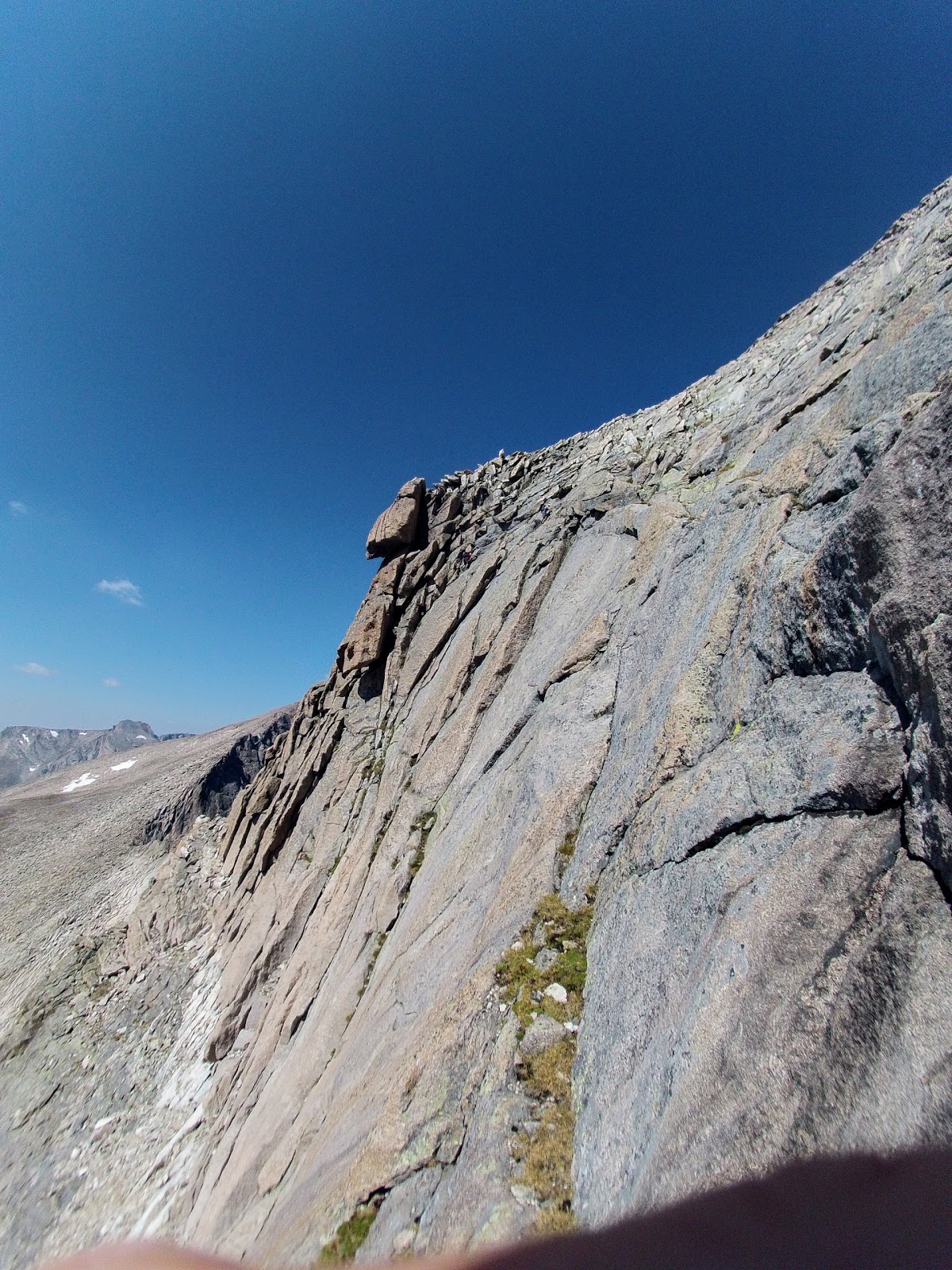
| The knife edge ridge leading to Mt Meeker. "The Beaver" and Longs Peak on the right. |
From Meeker I was excited to make my first trip up "The Beaver" or "Southeast Longs", the opposite side of the Notch from the actual summit. From the Beaver, you could say hello to the crowds on the summit of Longs -- however, the Notch makes it rather difficult to get there. Using Peter's GPS, I identified a chimney that I believed to be Gorrell's, the 5.5 downclimb to reach the bottom of the palisades directly. It went well at first but I hit several dead ends and wasted a bunch of time before finally reaching the talus beneath. My struggles seemed to be well enjoyed by those ascending the standard Clark's Arrow route below -- though some were horrified asking if they had climb
up that way (did you even look at the route or map before heading up!?). I wrapped around through the east side of the Notch and took the stepladder scramble to the summit. Longs was predictably crowded so I slapped the summit marker, bombed down the Homestretch (looking around unsuccessfully for my friend Joe who I knew was up there somewhere) and skirted off of the Narrows towards the Longs-Pagoda saddle.
 |
| The prominent tower of the Keyboard of the Winds |
Getting to Pagoda I was able to get a close-up view of the Keyboard of the Winds; I noticed two climbers on top of Pagoda, when I saw them leave the summit to the West I suspected I would either know them or they would soon be retreating back over the summit, stymied by the complicated west side. I tagged the summit of Pagoda just over 30 minutes after leaving Longs. Getting off of Pagoda to the west is notoriously difficult: the ridge direct goes at a radically exposed 5.7 that I don't wish to solo -- down, no less -- in running shoes. Kyle and I found a line earlier this summer that went a little easier but today I was armed with Peter's 3rd class sneak route! As I began traversing back southeast towards the sneak the two climbers yelled out to me, it was Bill and Dereck just starting a multi-day attempt on the LA Freeway. They weren't exactly sure what line to take but after some trial and error we all found the wonderfully simple downclimb to the ledge that would safely transport us to the Pagoda-Chiefs Head saddle. Motoring away, the last I saw they were just a bit behind me heading to Chiefs Head.
 |
| Look really closely and you can see Bill and Dereck following the ledges across to the downclimb off of Pagoda |
 |
| The Broadway-esque ledge providing easy passage off of Pagoda |
 |
| Bill and Dereck dwarfed in Pagoda's Southwest face |
 |
| Looking back into Glacier Gorge from the summit of Chiefs Head |
 |
| Looking towards Alice (left) and McHenrys (right) from Chiefs Head |
Mt Alice is a big mountain, its separation from Chiefs Head consists of a talus descent followed by a long stretch of tundra and then a section of easy but steep hiking to the summit. I felt really tired here so I just put my head down and tried not to ever stop. The summit came soon after, marking just about the halfway point of the traverse after 7 hours. The next peak Tanima is perhaps the most annoying summit to tag as it sits on a peninsula 0.75 mile out from the general line of the divide. The summit is nevertheless worthy as a vantage point to the entire basin.
 |
| Tanima (left) offers a long tundra jog between Alice and Isolation (big complicated looking peak in the distance) |
Moving from Tanima through the Cleaver to Isolation Peak was new terrain to me. Despite its profile and position, the Cleaver went at an exposed but simple 3rd class. The north ridge of Isolation looked like a great route but certainly requiring some careful route finding on steep 5th class terrain. Instead, I took Peter's advice and took ledge along the west face until a grassy gully opened above me. Although I added a 100ft or so of elevation change, this hiking route was surely faster and way safer than slowly moving up the true north face. Even after regaining the ridge, the summit of Isolation felt like a real slog. It was fun to look west at a new perspective of the
Fast Pfiffner Traverse route which climbs the west ridge of Isolation after descending to between Fourth Lake and Fifth Lake from the Alice/Andrew col.
 |
| The North Face of Isolation Peak, the west ridge sneak is visible on the right. |
 |
| Summit of the Cleaver, Tanima behind |
 |
| The west face of Isolation, Fifth Lake and the East Inlet |
Descending Isolation I began to have a pity party and seriously considered bailing to Pipit Lake. The prospect of exploring the Ogalalla - Elk Tooth ridge re-engaged me though, and I found a well of energy that enabled me to actually run a good bit of even the uphill tundra. Ouzel and Ogalalla pass quickly, at 4:30PM, this is actually the
earliest in the day I've ever found myself on Ogalalla Peak. By any route, Ogalalla is big day and today I was happy to not be so pressed for time as to not take in the beauty of the cirque of the Middle St. Vrain. These mountains are gentle on the west but fall sheerly to the glacier beneath on the east. The scale is so breathtaking I briefly consider hiking to Buchanan pass to fully experience the area.
 |
| Descending Isolation's south ridge and looking towards Ouzel (bump on the left) and Ogalalla (distant high point) |
 |
| Shoes and tundra |
 |
| Looking towards Copeland (far left) the Elk Tooth (center, distant) and Ogalalla (right highpoint) |
I begin downclimbing the east ridge of Ogalalla towards the Elk Tooth. The rock is in poor quality so I engage bypasses whenever possible rather than traversing each tower. I found in general, the south side of the ridge to be the safer and easier option. Still, care must be taken and I get cliffed out a few times on ledges covered in sand and loose rock. Cautiously, I regain the ridge at the saddle and stay generally along the crest in my final scramble to the summit which seems to be the last pinnacle still basking in the evening light beaming through notch formed by Ouzel and Copeland.
 |
| 4th class slab leading from Ogalalla to Elk Tooth. Wild Basin to the left (featuring Copeland) and Middle St. Vrain and the Indian Peaks to the right |
 |
| Same as above but with me |
 |
| The Elk Tooth rising above Middle St. Vrain |
At 6:00PM I am tired and hopeful to get back to Boulder for some dinner. The final two peaks look to be grassy knolls on a map but in reality look quite ominous after 12 hours and 13 other summits. Armed with the entirety of trails in Wild Basin mapped on my watch I decide to descend to the Hutchinson Lakes trail which ends up being a bit more complicated than I had hoped. I skirt through some cliff bands and find the trail to be in obsolescent condition. Nearly impossible to follow without GPS, a cairn only every 400ft and overgrown willows and krumholtz make travel extremely slow. When I finally reach Pear Lake I know the ranger station is only about 4.5 miles away. Unfortunately, the trail takes me on an eight mile wandering with needless ascents, twists and turn. Exhausted, I resign to my headlamp at Finch Lake and continue pouting along the trail. As darkness fully takes over I somehow find even more motivation to be done and again dig into a well of energy to jog the final miles to the car. In the end, it probably wouldn't have added that much more time to just add on the last two summits.
 |
| Copeland standing proud of the Hutchinson Lakes (lack of) trail |
 |
| Pear Lake |
 |
| Benighted. |
It was a great day! I summitted 13 named peaks in just under 15 hours. I was alone the entire day aside from the crowds on Longs and seeing Bill and Derek on Pagoda. I was most happy to really come to understand the routes which sneak around the dangers and perils of the more unsafe sections of the LA Freeway. Peter also bailed at Elk Tooth the first time he tried to traverse Wild Basin, finishing in almost the exact same time. Hopefully, it doesn't take me that long to return! If I can learn Gorrell's traverse better and having already figured out Pagoda, Isolation and Elk Tooth, I know I'll be able to move much faster on my next go -- whenever that is.
With all of the hype on seemingly a few overly classic and iconic mountains and routes its reassuring to know that a route of this magnitude, remoteness and obscurity is only a short 45 minute drive away. If you want to have an adventure away from the crowds, you need to get far away from a trailhead, on something technical and on something committing -- so basically, Wild Basin.
Summits:
Lookout Mountain - 10,715'
Mt Meeker - 13,911'
The Beaver - 14,060'
Longs Peak - 14,255'
Pagoda Mountain - 13,497'
Chiefs Head Peak - 13,579'
Mt Alice - 13,310'
Tanima Peak - 12,420'
The Cleaver - 12,200'
Isolation Peak - 13,118'
Ouzel Peak - 12,716'
Ogalalla peak - 13,198'
Elk Tooth - 12,848'