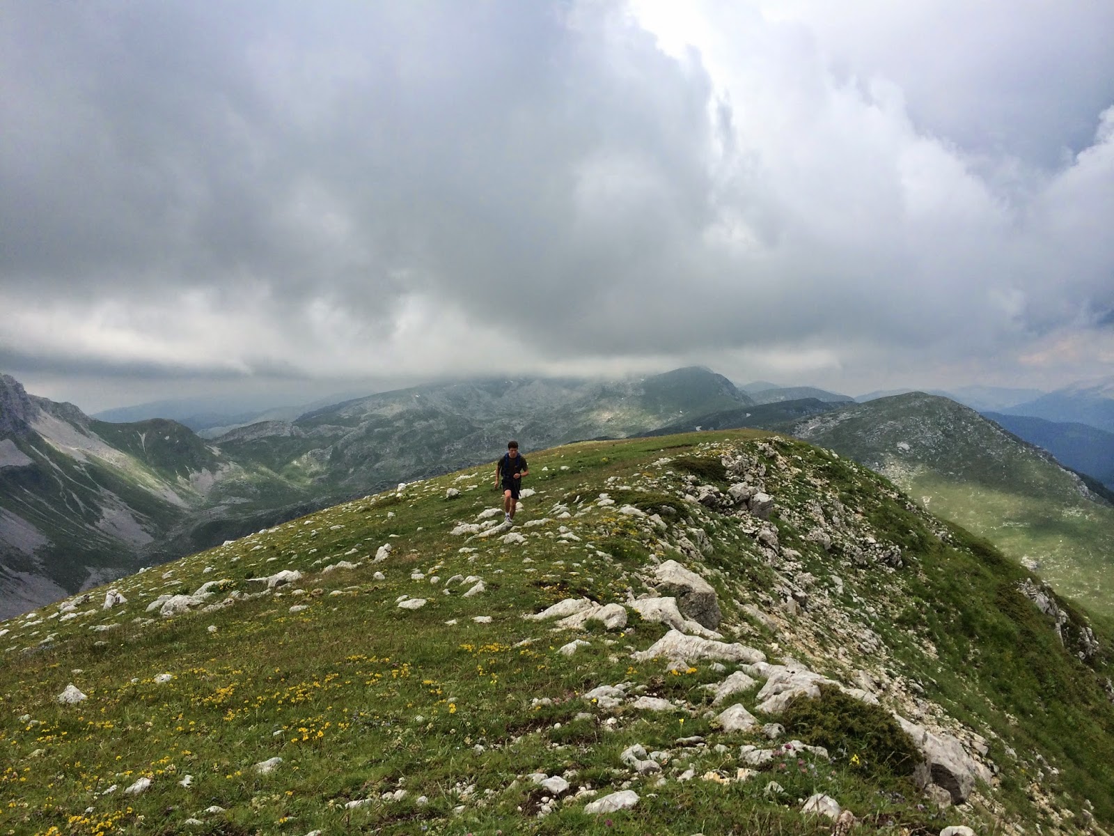
Saturday, July 19, 2014

7/14 to 7/20

Not even going to bother wasting space with the other boring runs I did this week, all easy 3-5 miles - simultaneous trying to recover from the Loveland/Bakerville traverse and get ready for this weekend.. Highlights were my buddy Nir forgetting his running clothes and going in cargo shorts and a polo and Mr. Krupicka following me into physical therapy. But I did do one thing kinda cool this week I guess. And I have a fair amount to say about it, and some pretty sweet pictures if I may be so bold.

7/19, Saturday - Four Passes Loop, 28 miles, 9:46 (8:54 moving), 8,200'


Firstly, I want to explain why I ditched Pikes. Pikes seemed last year to be the greatest thing, but when it was right on my doorstep I wasn't excited - at all. The thing is that I wanted to race Pikes; doing that on my own sounds like the biggest sufferfest imaginable (and not the kind I like!). Furthermore, the scenery on Pikes is (in my opinion) largely inferior to a lot of other areas in Colorado. Now what else did I want to do this summer? The 4-Passes loop! The timing is perfect right now, snow has melted and wildflowers are exploding.

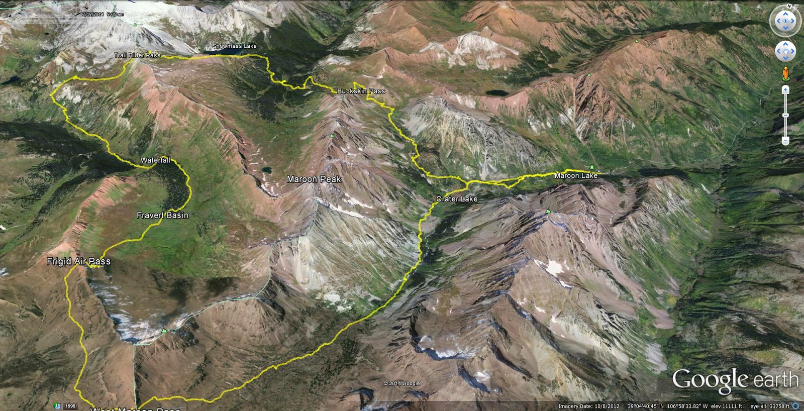
As a preface, this loop - the entire area really - is infamous. What are the Maroon Bells? A quick glance up from Maroon Lake exposes an image wildly popularized yet not often geographically credited. The Bells are dangerous, beautiful and inspiring. The Four Passes Loop takes the traveler on an orbit around the peaks over four 12,000'+ passes with startling views of the surrounding Elk range. A few names of prior runners on this loop: Anton Krupicka (4:46), Rickey Gates (4:35), and Lance Armstrong (5:40). Most recently Sage Canaday established a near unfathomable time standard of 4:27. Unfortunately, if one wants to keep pace with any of these celebrity athletes, the "easiest" (or should I say "least difficult") is Lance Amrstrong. Well, if you care to know more I'm sure you've heard of Google.
The route with some places labeled
I headed up Friday afternoon enjoying the parking lot on I-70 before bouncing over Independence Pass taking me just outside of the plush city of Aspen. Plenty of five-star hotels around this wealthy area, though I found the trunk of my car offered the best service around - complete with no amenities. After some minor route-finding issues on Tonahutu, I intensely studied (and printed off) the map though its a pretty simple concept: go around that hard to miss colossal mountain. From other reading I gleaned that counter-clockwise was the way to go, as to "enjoy" a pleasant downhill for the last 4 miles off of West Maroon Pass. I also made sure to pack some (I'll get to that later) calories this time. Looking back, Tonahutu was really just a disaster!
Ding-Dong, its the bells!
Started off as soon as it was bright enough to not need a light and made quick work of the gradual incline past Maroon Lake and subsequently Crater Lake. After the turnoff to Buckskin pass I passed one large group of ladies, then traded off leading with a couple of other girls (Usually I never see girls, but today I was the minority). They also had never done the loop, though were more accomplished and experienced "ultrarunners" than I am. I really hate the word "ultra-runner" and "ultra-marathon" it sounds so arrogant and pompous. Anyways, we talked briefly before I headed down Buckskin's west side. One pass and 3,000' done.
Cascading waterfall on the Buckskin's East side
A pretty view of (let to right) Pyramid Peak (14,018'), North Maroon Peak (14,014), Maroon Peak (14,156'), Sleeping Sexton (13,460'), and Pt 13,039'- I  checked the map
West side of Buckskin Pass which drops down to Snowmass Creek
I find it especially important for me to push downhills, because I'm learning that its my only real qualifiable strength in trail running. I slithered down the winding trail passing a pond...or two, who knows I saw a lot of things! Eventually the trail dumped me into a swamp with no obvious direction to head. I pulled out my trusty map and I appeared to be in the right place, yet there was certainly nowhere to go. Eventually the two girls caught back up, they immediately decided to backtrack a bit, and we found a turnoff about 50ft back up the trail that cleanly crossed a waterfall on a log bridge. Nice. They stopped here to refill water as I continued on towards Trail Rider Pass.
Just before the bridge with another nice view of the Bells.
Popping out of treeline for the second time, my eyes welcomed the sight of Snowmass Mountain (14.092') and Snowmass Lake. After tromping through some Cordis height willows it was grassy switchbacks to the top of the pass. The girls gave chase from behind but could never make up the distance (that will change later). We talked about running shoes (typical) and had a bit to eat at the top of Trail Rider Pass before I led the charge down the opposite side of the pass. These pictures are so cool and they don't even fully capture the beauty! Two passes down.
Snowmass Lake with some peak I can't identify on the Snowmass massif
Looking down the East side of Trail Rider pass. Plenty of snow visible, but barely any on the trail.
Snowmass massif and Snowmass Lake.
East from Trail Rider Pass
West from Trail Rider Pass
The west side of Trail-Rider pass is steep and pretty loose with crumbling and rocky debris as is common with the Elk range. In other words, a perfect downhill! Given downhills are my only viable method as staying in front of the girls I pushed it a bit. Its not that I didn't like them (they were pretty neat!), I just have my childhood ingrained masculine and testosterone fueled instinct that I must defeat them. The trail eventually levels off and reaches its low point at a creek crossing. The sun was beating down on the practically shadeless alpine basin and the ice cold water felt amazing. A backpacker asked me "Are you doing this in one day?", I responded, "Hopefully, otherwise I'll be out here for a really long time". The area I was now in is called Fravert Basin and it is carpeted with wildflowers. I only know the names for Columbines (Colorado's state flower) and Indian Paintbrushes (my Mom probably told me), so I'll be relying on potential future input from my Mom and her sisters for any future classifying edits.
Indian Paintbrush
Yellow, looks like a sunflower but who knows
White, I'd call it Small White myself
Purple (People Eater)

Columbine. I love this flower, and they were everywhere!
Pink, I'd call it Patrick Star, not a good picture though
Light Pink, I got nothing
I was shortly thereafter passed by a dad and his son doing the entire loop. The kid looked 12 or 13, arguably way too young to be going such a great distance (hey, maybe no one is!). Kudos to the kid regardless, that's pretty or rather insanely cool. I came across a huge waterfall, the picture is terrible, but honestly, it was 40ft tall, at least.
Fravert Basin
Waterfall!
Closer view of the waterfall.
Climbing up to pass number three, the days travels really started to weigh on me, already at near 5,000' climbed and 14 miles, it was already a solid day of work. Now factor in that I had 3,000' and 14 more miles left...well, its hard to deal with both mentally and physically. My pace faltered to a semi-power hike. I had finished my water, and wasn't yet high enough to be comfortable refilling from a stream quite yet. I also didn't want to hit my last gel quite yet, so I dug deep and trudged up the muddy singletrack. Soon enough, one of the girls appeared behind me - and passed me. A few minutes later the other followed her partner's lead. I tried catching back up to no avail.
Mentally miles 14 to 18 were the hardest. Saying you're halfway done here is a really grim thought!
I hit the last gel and arrived at the top of Frigid Air pass with the girls already sliding down the precarious slope. You will not defeat me, I vowed. I bombed down the hill and eventually fell in behind them on the rolling basin on route to the final pass. We made it up the final pass together - well, I was second so only got beat by one girl, but whose keeping track (me...). West Maroon pass is perhaps the most popular as a day hike, so we were suddenly greeted with a full party of people. I was so focused on keeping my physicality and emotions in check given my easily foreseeable soon to arrive bonk that I didn't get a single picture of either Frigid Air or West Maroon. Shame, there were excellent views of Pyramid Peak from West Maroon whether or not I took a picture. Its easy to get cocky here, its all downhill back to Maroon Lake - what a breeze right? Wrong. My legs had just been tortured with 8,200' of climbing not to mention my burning lungs, audibly pounding heart and energy depleted mind. Its also 7 miles, which while having already ventured much further than that, isn't a negligible distance. We stayed essentially as a group for the first 4 or so miles, then I completely crashed. Not falling (thankfully), but my dry throat objected with a rough cough whenever too much air was inhaled, making running quite difficult given I had to restrict my breathing. I casually walked the final mile and a half just wanting to be done. Perhaps obviously, these were the hardest miles physically. At first sight of Maroon Lake, I forgot how tired I was and jogged down to the water to enjoy soaking my legs in the ice cold waters with the girls who were great companions and most welcome company (and competition) over the last 9 hours. What a day.
Shoes off to ice in Maroon Lake!
Exactly double Sage's time (well, with my moving time...), I also learned he didn't hike until the final pass which I can't even understand. I hiked some on the first pass (and the entire 3rd and 4th)! Sage went fast with plenty of nutrition, but also impressive is that Anton went out casually (not at all with intent to go fast) with his standard gear: single water bottle, a few gels, no shirt, shorts, shoes. I really think if he didn't overtrain - meaning not running Longs Peak and Green Mountain everyday the week of a race - and peaked for an event he could give Kilian a run for his money (okay, maybe). Still, I'm reluctant to even consider my time as this was one of my greatest accomplishments, ever. Its a serious route, with serious mileage, elevation gain and altitude. The views are unbelievable the whole time. It would be a spectacular backpacking trip as you would get to see so much more with more time and lacking the constant immediate focus on the ground which running commands. If you ever have the opportunity to do this loop -whether running, walking or whatever - this is something truly special and one of a kind.

Lastly, after Tonahutu I felt like I was completely set on nutrition today, considering I actually had it. Not so, it would seem. I brought a single 20oz water bottle initially filled with Tailwind and refilled 3 or 4 times with plain water, 3 gels, and a tortilla filled with Nutella. The reality for me is that on outings longer than about 3 hours, I need to be getting around 100 calories about every 40 to 80 minutes. Today, an extra two gels would have been very welcome. Also I tried Honey Stingers today. They work, but taste horrible to me.

Week Totals:
Miles: 43
Vert:: 9,160'
Time: 12h2m
-Notice how 90% of it is from Saturday :)

I think I'm going to take a week or so off now. I've been training really hard lately and I'm starting to feel symptoms of overtraining and burn-out. I'm almost certain that overtraining lead to my stress fracture last summer, and the last thing I want now is to get burnt out or injured with so many possible adventures left.

If you actually read all of this, I'm impressed. Happy trails.
Sunday, July 13, 2014

7/7 to 7/12

7/7, Monday - Short n' Fast, 3 miles, 20min, 80'

I finished Scott Jurek's Eat & Run at 10PM and had to go for a run. Went fast for a bit - initially going for a sub-19 5k - then remembered its night time and I ran a marathon two days ago. Technically it was 2.6 miles in 18:20, whatever, icky details :).

7/8, Tuesday - Track, 6 miles, 1:00, 0'

I've been afraid that I'm getting slow with all these long arduous runs that inevitably feature hiking so I don't mega-bonk (though I still often mega-bonk). So I headed over to the Boulder High School track and did some speed work: 5x100m, 4x200m, 3x400m, 2x800m, 1x1,600m. Trying to break 6 on the final mile it seemed I was too late with my kick and I crossed the line at 6:19. I suppose I can use the marathon as an excuse for that; wonder how many more days that one will be valid!

7/9, Wednesday - Boulder Canyon, 9 miles, 1:08, 500'

I certainly had something in my legs today I wasn't anticipating! Started off in a slight rain, which always gets me excited and I just never got too tired. Was able to hold a healthy 7:15 min/mi average the whole time (7:50's up, and 6:40's down). Got up the canyon in 34:32 (faster than I've ever run down!), then headed back down in 31:25 for a my first time up and down under 70 minutes. Had a nice conversation with a cyclist for about a mile too, which I guess shows how good I was feeling today. Someday I'll go for a sub-60, maybe... or something.

7/10, Thursday - AM: Second Flatiron, 3 miles, 1:40, 1,300' | PM: 3 miles barefoot

Didn't run a step and just felt off today. It was nice catching the sunrise on the rock though. I tried finding Baker's Way - a 5.3 up the First rather than the 5.6 standard. I ended up at the same stupid 5.8 "Kamikaze's Overhangs" thing I did on accident once - and will not do again. So I down climbed and trotted back home.

After work I headed over to a nearby field and did some barefoot laps. My gait has been feeling a bit off lately and I find some barefoot running usually provides enough ground feedback to make the minute adjustments needed.

7/12, Saturday - Loveland Pass to Bakersville: Mt Sniktau (13,234'), Cupid (13,117') [unranked], Grizzly Pk (13,427'), Torreys Pk (14,267'), Grays Pk (14,270'), 13 miles, 5:29, 6,300'

Another example of this blog's namesake "Glorified Walking", how much running do you think I (or anyone besides Kilian Jornet, who did something(s) special recently) could do with that much gain in a relatively small mileage. Big scenery and plenty of peaks in the bag. Started from Loveland Pass, snagging Mt Sniktau before setting off onto a rollercoaster of a ridge which stays at an average of 13,100' for 7 miles of horribly loose and steep scree.
Torrey's is the high point in the center, Gray's is behind it. We got work to do.
Even Grizzly was hard! despite only being 200ft higher than Sniktau you get ~1k' of gain going over (summitting the unranked Mt. Cupid on the way). Barely paused on the summit. I caught up with some other runners who were doing only Grizzly and Torrey's - though as an out and back which is very demanding. The traverse from Grizzly to Torrey's is insanely steep, it gains a little over 2,000' in about a mile (that's an average of 38% grade if you were wondering). There were 4 of us "runners" heading up and not a step was ran!
Appropriate reaction to impending doom climb

What is this crap? Other runners in the background.
Getting over to Gray's was far more arduous than it was last time when I took the "easier" way up. Hustled down as the sky broke into thunder and lightning and rain. Still, people were heading up the mountain casually into a death zone of wet rock and electrical storms like they wanted to get toasted. Personally, I heard thunder and I hit the gas.
The brighter arc of snow in center is the first 13er (Sniktau) I summitted, only one 14er left...
Summit of Torrey's at 14,267'
Looking west off of Gray's
I waited out the brief but heavy rain under a trail head shelter for maybe 10 minutes. I jogged 80% of the road down to the highway till I got a ride back to the highway (and my mommy who hiked and kindly drove the car down to pick me up while I ran). This actually had a net negative gain as I did more downhill than up (5,200' ascended, 6,300' descended). I count it though - so deal with it.
Long 4,000' descent.
GPS track
Hello, you're a pretty one. Summit of Mt. Cupid.
Not quite as much total volume this week (two days off), but it was good nonetheless. Retrospectively, it is weird to think I did a marathon a week ago, it seems like that was months ago.I'm planning on doing my Pikes Peak Marathon next weekend, so this week should feed into that nicely. That being said, I'll probably not be doing any vert whatsoever until next weekend so that my legs can carry me up and down that behemoth mountain. I'll be really trying to race on Pikes, under 5 hours would make me really happy. Really nervous but really excited for it!

Week Totals:
Miles: 37
Vert: 8,255'
Time: 10:08:25

Sunday, July 6, 2014

6/30 to 7/6

6/30, Monday - Green Mountain + 2nd Flatiron, 9 miles, 3,800ft, 3:26


Joined up with a local running group for a run up Green. My legs were still pretty wrecked from my high mountain double on Saturday and I felt them the whole way up. These guys are by no means casual runners, most were wearing shirts with distances from 50 up to 200 (not a typo) miles. It was hard work staying middle of the pack, and I really struggled towards the end. I was tired from my weekend, but I was sure they weren't sitting around either. So I just held pace as best I could. I did keep up with the front guys on the downhill though. I'll be running with this group again without a doubt.

After I finished that, logistics just so happened that I had some friends coming to Boulder to climb the Second. I couldn't not. We finished just about as darkness fully took over. Legs feel like they were injected with acid, about 10,000ft of climbing in the last three days.

7/1, Tuesday - Track 6 x 200m, 4 miles, 100ft, 0:37


Haven't been on a track in a while, It was fun to be "back" - though I've never really been "there" in terms of track. Was right around 40 seconds for each 200, so it was a nice "off" day run. My quad had a near apocalyptic cramp hurdling the fence on the way home. True sign of good run!

7/2, Wednesday - Mt. Sanitas, 7 miles, 1,500ft, 2:00


Ran to Sanitas to meet my friend Danny after which we hiked the hill together. Absolute mile time degradation as the times kept going up as I felt more and more the cumulative load. The first 4 went 6:50, 7:54, 12:15, 21:32; granted the last one was completely hiking. Taking the next few days easy so I can accomplish my weekend goals with at the very least mostly functioning quads.

7/4, America Day - 2nd Flatiron(s), 3 miles, 1,800ft , 2:00


First off I was out the exact same amount of time today as Wednesday, kind of cool (2:00:06 both days). Hiked to the base of the rock and hit a lap up the 2nd in 9:02, a PR, but so tantalizingly close to sub-9 that its taste was bittersweet. Downclimbed leisurely in 36 minutes where I met another fellow blogger whom I follow, Kendrick (check out his site its pretty cool). I talked with him as he ascended and I descended, he was doing a few laps today as well. I met up with him again at the base and after we helped down a couple girls who had climbed up a bit more than they maybe should have. Kendrick said he had never broken 10 up the rock, and from what I've read on his blog, I feel like he should be going faster than me. We took a lap up in ~9:30 (I left my watch paused on accident, so I took a few seconds off his time), his first sub 10. A bit of an annoyance, as we were climbing up, a guy resting about half way up cut behind me (and thus in front of Kendrick) saying he wanted to follow us. He was able to hold with us for like 20 feet. Seemed pretty rude in the moment (I'm sure that wasn't his intention), but it was sort of frustrating as we were both trying to go pretty fast and maintain our flow. Jogged back down with Kendrick before heading back home.

7/5, Saturday - Tonahutu Loop, 26 miles, 5,100ft, 8:30


I woke naturally around 4, so I figured I might as well head on over, I was up later than planned for the 4th, so I was tired and took a short nap at the trail head before heading out.
Had to pull over to get this sunrise!
The trail started off easy enough, or rather it started with a downhill which is something I'm not a fan of. Nice path, typical dewy mountain morning with crisp air. The trail rolled along meandering upwards, but just. After passing a few hikers and two runners who were heading home from their morning run I came upon my first waterfall of the day!
Roaring Rapids
Typical section of trail, though it had some scattered downhills as well.
At mile 5 I reached for my first electrolytes...Oh no! My quick nap had discombobulated my routine and I had forgotten both my energy powder in my water and my "Nutella-dilla" (panini pressed tortilla filled with nutella, it works awesome). Okay, so it looks like we're going to change things up a bit. I did end up finding an old cliff bar in my pack so that provided some solace, but I adjusted the game plan. Originally I had wanted to go around ~5:30 for the loop, now I decided I wouldn't worry about time and I would taper my efforts. I hiked anything that made my heart-rate spike - that's when your body grabs carbs that I wouldn't be able to replenish. This meant power hiking near everything that was uphill today.
Nearing Treeline
I broke treeline and began the switchbacks up to the Continental Divide. These switchbacks were carpeted with wildflowers and also had a sprinkle of elk herd thrown in. Not picturing the elk as they were a bit far away and the picture is majorly pixelated.
I am nature.
Marching up to the Continental Divide
Snow was ever present here and it was so soft that even my slender frame was tunneling through to the hidden icy rivers beneath. Despite being somewhat displeased thus far with my Altra Lone Peaks, this sort of long and non-technical jaunt is what they appear to be designed for, they performed great - and dried fast - all day long. Made it up to the Divide and started the longer than expected traverse across the alpine tundra - still hosting plenty of snow. I made it to the junction for Flattop Mountain where suddenly there were tons of people, they had been more sparse previously. Flattop isn't necessarily grandiose and I wouldn't seek it out again, so I settled to climb it.
Summit of Flattop, also notice the massive summit block of longs in the top right.
 I've also been trying out calf sleeves a bit lately (as can be seen in the pic). They do seem to aid in recovery and delay soreness on longer outings. Though if truth be told, I'm not quite fond of the road-biker-esque appearance of them. I then descended and finished the traverse across the Divide.
Wished I had more energy to run all of this!
The descent was a long, long, long rambling. I could without a doubt feel the absence of electrolytes/sugars/carbs so I still walked an disappointing percentage of the trail. The low was definitely bumbling through a burn scar about half-way back down. A field of deceased life certainly doesn't bring my spirits up!
Feel horrible, nature commands it.
 My spirits were eventually lifted by (leaving the burn scar first and foremost) another waterfall - Granite Falls. Everyone loves waterfalls, everyone.
Granite Falls
I kept on descending and passed a family setting up tent. More accurately two parents were scrambling to keep everyone's needs at bay whilst attempting to erect a couple tents. I was ready for another break at this point so I offered my assistance. After constructing the campsite I learned that the mom was hiking back down to meet the grandma and didn't want to hike alone. It worked out that I hiked down with her, and thus the dad could try and wrangle the children. We  conversed about critters of the forest, mainly the danger of moose encounters compared to other animals. Ironically, we came across a hefty moose about 5 minutes later. Obviously we were on edge a bit, but we kept our distance and admired its splendor. We got back to a different trail head then from where I started, but they graciously drove me back to my car (this was actually the plan)...and perhaps more importantly gave me a snickers bar. It always strikes me how I picture this great emotional moment at the finish, but in reality you just casually get back to a quiet parking lot, and drive home like any other day.

So, huge day; I would have liked to go much faster, but alas sometimes just getting it done is more important than anything else. I'd say it merits a rest day.

Week Totals:
Miles: 50
Vertical: 12,400ft
Time: 15:43

Sunday, June 29, 2014

6/23 to 6/29

6/23, Monday - Green Mountain, 10 miles, 2,800ft, 2:25


Got back at 4:30 AM from Italy (obviously in the dark) and thus didn't get to see the Flatirons. After 4 hours of sleep I arose and headed up to Chatauqua. Uphills were a real struggle, not that even the downhills felt any better. Jet lag in full effect but I was happy enough to be back that it didn't bother me too much.

6/24, Tuesday - AM: 2nd Flatiron, 3 miles, 1,300ft, 1:03:48


I woke up around 2 or 3 in the morning so I killed time until there was enough light to head out. Low lying clouds provided a mysteriously themed scramble in ~17 minutes. I felt horribly uncoordinated most of the time, whether it was my legs, sleep schedule or being my first climb in my Altra Lone Peaks' I couldn't say. Saw some deer and got above the clouds, so it was a good morning.
Atop the 2nd Flatiron above the clouds

PM: 2 x 1 mile, 5.5 miles, 100ft, 39:40

Went out again after work feeling surprisingly well for being awake for around 15 hours at that point (coffee, coffee, coffee!). Did some interval miles: 1 mile warm-up (7:44), 1 mile hard (6:30), 1 mile easy (8:15), 1 mile hard (6:18), 1.5 mile warm-down (8:00 pace). Feels good to feel horrible sometimes. Almost angry at myself for finding such pleasure in a type of workout I normally consider myself to despise.

6/25, Wednesday - AM: 2nd Flatiron, 3 miles, 1,300ft, 52:42


Nearly fell asleep on the move today, I actually took a break at the base and then another half-way up the climb. Lazy scramble in 19 minutes, but I felt much more coordinated on the rock than I did yesterday. PM: Grabbed another easy 3 miles after work with some friends along the creek path.

6/28, Saturday - AM: Mt Sherman (14,035), Mt Sheridan (13,748), 8 miles,  3,400ft, 3:37:02 | PM: Collegiate Peaks Tour, 10 miles, 2,300ft, 2:49


Slept at the trailhead in the midst of a fairly strong wind hoping it would subside by morning. It didn't at all. The morning was cold, cloudy and even more windy. I scrunched up my face and headed up the trail. Should have waited longer to start, so the snow could soften as I ended up having to ascend a fairly steep snow field that was nigh ice. In the end I remembered a technique I read about using small rocks as makeshift ice tools, it works amazingly well actually. First headed up Sheridan where I was completely engulfed in a cloud and even more wicked winds. The cold screwed up my camera battery, so I only got one picture from the whole outing: this one from the summit marker on Sheridan.
I was hunkered down behind a rock wall. I wish the picture could capture the wind!
I was sort of apprehensive about getting disoriented in the cloud and descending the wrong side. so I constantly made myself point back down to the saddle. I danced down the scree back to the saddle and started up Sherman. After turning a corner and being slammed with winds that seemed could blow a 130 pound dude off of a mountain I turned around. After descending the snowfield I was looking back up and decided to just go up the scree on the less windy side. Made it up, finally. A few things regarding Sherman: it is not fun, it does not have good views, it does not have any geological form (in other words its Cameron's best friend). Whatever, another one to add to the list.

After a sandwich I decided I wanted more!

Leaving from the N. Cottonwood trail head near Buena Vista I did a rambling tour of some of the Sawatch Range. I thought about going for a summit, but these guys are pretty big and even the smallest would denote at least 4,000ft of gain. After 4 miles of beautiful and well maintained trail (seriously its beautiful), I climbed up a bit of scree thinking to summit Mt Harvard, but I got up the first part and another blast of wind nearly blew away my prized "Best Rental" hat. I also was needless to say quite tired at this point. I bumbled my way back down and ran into an old acquaintance from the dorms last year. It's so cool seeing people you know out in the wilderness. Definitely a stellar training day with 18 miles and 5,800 ft of climbing at an average elevation of around 12,000ft. I was at altitude a while in terms of time too, 6 hours of activity, but I slept at 12k and never really dipped below 10k all day. I'll be back in this neck of the woods for sure.
These guys are big. I also now realize I was dressed like a hunter (Bright Orange & Camo)
Tired feet with the crisp dirtline.

6/29, Sunday - Marshall Mesa, 5 miles, 400ft, 43:52


Thought about heading for the hills again, but I'm glad I didn't. It would have been a wasted drive up because there is now way I could have gotten up anything at all after yesterday. It was a hot and shade-less venture. I seem to always have my most exhausted moments all in a certain area of South Boulder. Weird.

I'm really happy with my legs right now. It seems like they are finally coming around and realizing that 10k vert a week is normal. Still can't quite touch 15k yet, but I suppose its a progression (or an injury, my pick). Totals for the week were 45 miles and 12,000ft of vertical, feeling pretty good.

Monday, June 23, 2014

Italy

Tuscany: 10 miles, 900ft, 1:24

First run after a week off. Essentially being at sea level did wonders for my speed. The calculated average pace may not totally reflect that, but I was stumbling around twisting farm roads which often lead to nowhere or onto someone's farm, so there was a lot of "navigational" pauses. Pretty cool area to run around nonetheless.
It's pretty nice

Croda del Becco Seekofel (9,219 ft): 17 miles, 5,400ft, 4:45.

Going into Italy I had only one plan set in stone regarding running: something mind blowing in the Alps/Dolomites. Prior to arriving in Cortina I had only ran once over the last 10 days: an exploratory run meandering over rolling farm roads in Tuscany for a fun 10 miles of sightseeing. Three days later, emerging from a tunnel the scene was immediately set for an extraordinary adventure.
View from the hotel
The Alps are starkly different from the Rockies in three ways: steep, green and culturally. Ridge lines of pointed teeth pierce the clouds while merciless near vertical faces stare down at the relatively insignificant creatures below. Trees and alpine meadows prosper at the comparatively lower elevations. Lastly, the entire landscape is sculpted by a very different history. A well maintained network of trails, refuges and well signed junctions defines the Alps. A long history of sustained living distinguishes this area from the miners and commercial ski industry which have (or had) a hold in Colorado. A quick 6 mile jaunt the first night was tantalizing - I needed more!
Cortina
Andrea, his girlfriend and I set out bright and early...or scratch that. We feasted like kings on the wallet burning inn's breakfast which we had already paid for. Not to waste a penny, I had croissants, donuts, rolls, juices, cheeses and meats. I mean you can't not! We got to the trailhead at ~10. The view from the car:
Summer is decidedly more present here than back in Colorado
After picking my jaw up off of the ground we set out as a group of three casually walking a half mile before Andrea and I broke off. The run began with brutally steep, yet groomed and runnable switchbacks for a few miles gaining just a bit under 1,000 feet. Subsequently, we found at ourselves at the first lake of the day.

The following 3 miles contained dispersed though frequent uphills. We were able to run near everything but we didn't hesitate to slow down when we needed to. The trail eventually brought us to our primary objective for the day:  Refugio Biella. 
From left: Refugio Biella, Andrea, Croda del Becco Seekofel
It didn't take long for our eyes and thoughts to drift over to the nearby summit which according to the map is "Croda del Becco Seekofel". "That actually doesn't look too bad at all, let's do that real quick" we decided. Perhaps arrogantly I thought I could power myself to the top in a few minutes without any extensive effort. It didn't take long for me to eat my words. The summit was much further away than we expected and at least for us, too steep to run for the majority. Still, our new objective would not be set aside. 
Tons of crucifixes and crosses in these hills. This one at the base of Croda del Becco Seekofel
It's moments like this where I know that had I turned around it would have weighed upon me heavily until I made it back - which in this case was likely never. We pressed on. Some steep trails and residual snow later we found ourselves atop a "mom-worrying" cliff. I would estimate it was 3,000 feet down myself. It was capped by cornice which appeared days from collapsing. Views fulfilled my goal: mind-blowing.
Oh yes...
The cliff amounted to be the biggest thrill of the climb as the true summit was a mound distanced from any geological wonder. I ate my American Cliffbar and Andrea ate his honey, raspberry jam and bread rolls, really. When small snow flakes began swirling in the wind, we figured we should get going before our shorts and T-shirts got the best of us. 
Summit cross
Descending I realized how worn my shoes are. I might as well have worn Tom's or even socks. If you want to know what every sharp rock on that trail feels like, contact my poor feet. We met his girlfriend at the refuge at the base of the climb. They hiked for a bit as I ran down ahead and climbed up a grassy slope which ended up being a rocky face instead. Typical. By the time I was back down Andrea caught back up and we jogged back down some steep (noticing a trend) steps passing a few beautiful, crystal clear lakes. 
Andrea dropping back down to Refugio Biella
Back on the main trail, Andrea meandered up a bit to meet his lady and I went off on another spur to add some more miles and vert. The steepness of the Alps are unforgiving on legs that are already at 4,500ft on the day. It was all I had to get to 5,400ft before turning around as rain began to fall. Opened up the downhill hard until I rejoined the crew and we finished together, just as we began the day.
Heading back down

Castella de San Vincenzo, Mt Mare (6,552): 13 miles, 4,800ft,  3:48

Two days later, we are nestled in a small house in the range. Arriving at dusk, silhouettes mask the true form of the mountains on the horizon. Sunrise brings with it the realization of how prominent these peaks stand themselves, though in a completely different climate from Boulder or the Alps. The ground is saturated with water and undergrowth blanketed by a canopy of trees until timberline.
Wet and Humid and Green
A morning study of the map, a quick breakfast of honey and bread, and Andrea and I are jogging down the kilometer of road before the trail begins. I'm quick to learn from Andrea and discover for myself that this is a less popular national park and this receives minimal funding for trail maintenance. A mess of fallen trees litters the first 10 feet of the trail and not long after we are carefully crossing a steep gravel slope where the trail had collapsed down to the gorge some 40 feet below. Weary from days past we avoid stops in fear that we may realize we are too tired. In any event we ended up feeling rejuvenated by the movement rather than drained by it. Perhaps 100 muddy, scarcely marked and steep switchbacks later we emerge out of the trees for our first glimpse back at the castella de San Vincenzo reservoir 3,000ft below us at which we started.
Looking back down. We came up through the "V" starting at the lake just beyond.
Looking up to Mt. Mare from timberline.
Above stretches a grassy ridge line which appeared to be one of the "way bigger than it looks" or actually not too bad. For probably the first time ever, it actually wasn't too bad. At this point the trail was no more, so we trudged up the wet grassy slope. Summited in 2:20. We ran next to nothing going up as it is pretty steep, but it is certainly possible to run most of this route. Still 4,800ft is a long time to push hard. 
Andrea on the last feet to the summit.
Some darker looking clouds were gathering around nearby peaks so we didn't linger on the summit. Andrea began his descent as I quickly scampered across to a cairned sub-peak  and thereafter began my own trip back down. The steep slick grass provided little purchase, especially now considering a down word momentum. I caught back up at tree line and we bushwhacked our way through nettles and thorns to the faint trail leading back to the valley. What took eons previously we were able to zip down while carefully leaping and juking over and around nature’s arms reaching across the trail.
Typical section of "trail"
Andrea toyed with switching from a heel to forefoot strike and was greeted with the excruciating lower calf soreness which accompanies the switch. Returning to pavement, we elected to run directly into the lake. It wasn't necessarily hot (though it was humid); the day's efforts were washed away in the cool blue water.