Wednesday, December 31, 2014

Last Few Weeks & 2014 Recap

12/7 - South Boulder Loop - 21 miles, 2,200', 3:35
Pretty blah and boring long run. South Boulder Creek paths to Marshall, some connector to Mesa, eventually to the creek path, through campus and back home. I went slow as this closed out an 80 mile week, so I was feeling the miles quite a bit.

12/11 - "Royal" Flatiron Quinfecta - 9 miles, 5,900', 6:39
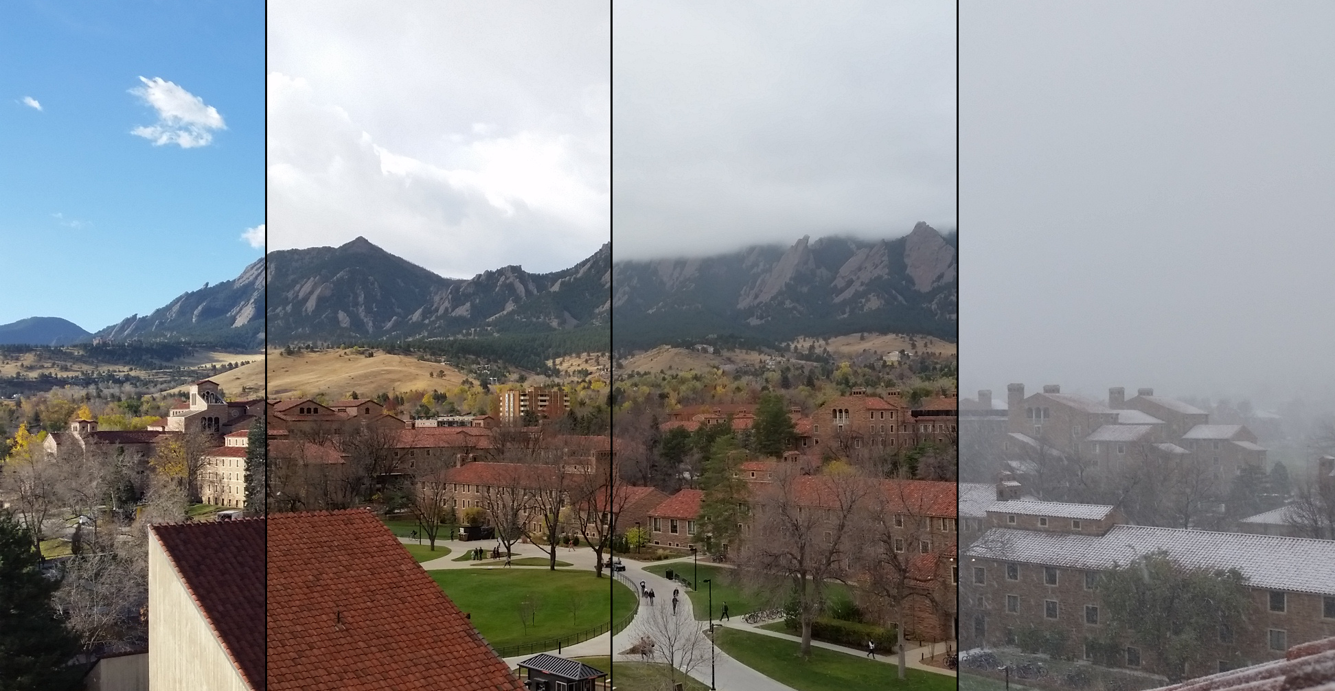
Big day. See here.

12/13 - Front Porch, Regency, Royal Arch - 6 miles, 2,600', 3:56
Easy day out with Andrea before the finals crush. We started up what we thought was the easy Tiptoe Slab route which is rated at 5.3. We ended up on the Southern edge of the rock, I ended up making a move that felt 5.6ish that Andrea didn't want to do, so I found my way to the top, downclimbed, then met up with him again after he had traversed like 200 feet horizontally across the rock. We started up a much easier route, then Kendrick and his friend breezed past us on route to some colossal day. I guess his Quinfecta recovery went faster than mine! All in all, the scramble was quite enjoyable once we got the route right. Next we scrambled up the 5.2 El Camino Royale on the Regency, which was quite fun aside from the approach. This leads perfectly to the Royal Arch - I'd bet no one has done the Regency and not Royal Arch.
Andrea taking a leap over 3rd on the Regency
Week Totals: 36 Miles, 10,800', 14h9m

12/15 - Streets - 4 miles, 200', 0:35
I felt like I had been living off of campus pizza and caffeine. Which I had been, during the study marathons...

12/19 - Front Porch, Stairway to Heaven, Regency, Royal Arch, Hammerhead - 5 miles, 2,800', 2:47
With finals done and my body full of all sorts of caffeine related toxins and about half a meal a day I was expecting to just flounder about, but the gods were kind and I felt fine. Dialed in the Tiptoe Slab route on the Front Porch, then shwacked through all sorts of undergrowth down to Skunk canyon to enjoy the lovely 1,000' foot Stairway to Heaven. I skipped out on Like Heaven, someday. After another equally detestable shwack I made quick work of the Regency/Royal Arch. A warmly welcomed trail - ableit it was mostly ice - lead me to Yodeling Moves on the Hammerhead. Its a pretty straightforward scramble with Freeway-esque ease. I read that you could actually get on the summit block but it looked heavily overhanging so I descended back to the car.
Shadow squatting jumping-jack thing
A lot of these approaches, and descents are pretty terrible with snow, undergrowth and so forth. I'm not sure why I enjoy them.
12/20 - Regency/Royal Arch - 4 miles, 1,500', 2:45
Hikin' round with some friends up the Regency and Royal Arch.

Week Totals: 13 Miles, 4,500', 6h7m

12/21 - Front Porch, Angel's Way, Hammerhead - 6 miles, 3,300', 3:07
I recently exchanged my climbing shoes for a bigger size - I had taken the "they should be tight" mantra to an extreme when I bought them 5 months ago. Naturally, I had to try them out, so despite not being on rocks I would normally wear sticky slippers, today I indulged. Front Porch is now completely figured out. The traverse from there to Angel's Way was predictably horrendous. Angel's Way seemed spectacular, but there was so much cold wind that my fingers kept going numb. In particular the high point was dreadfully cold, making the not insignificant downclimb excruciatingly cold. I definitely added a lot of time to this trip from stopping to warm up my fingers. I'll return under sunny skies. Given the conditions I decided to skip out on Stairway to Heaven, Hillbilly Rock and the 5th in favor of some smaller more sheltered routes - well, only one. I followed what I had to believe was Anton's prints in the snow (they had the resoled dot rubber, and from his blog I know he's been up there), which lead me to the Royal Arch trail. I aimed to fully scramble Yodeling moves. The east face was cake, I walked around the back and found the ledge up to the summit. Its super easy but is a very exposed face. Despite having water and gels for a much bigger day, I was more than done with the cold wind, so I called it.
The ridges of skunk canyon. From left to right: Mohling Arete, Angel's Way, Satan's Slab, Stairway to Heaven, Hillbilly Rock.
My hands were so cold. This brief moment when the sun finally poked out was treasured as gold!
12/22 - Skiing at Eldora - 14,700'
Not too much was open so it was mostly just getting my feet under me again. As is typical with the first day of the year, I was pretty sore. The vert I list is only descent - I'm not Kilian - I use lifts!

12/24 - Royal Arch Hike - 4 miles, 1,800', 2:40
Hikin' with mommy!

12/26 - Skiing at Eldora - 14,000'
Big snow falling all day, all but 2 runs opened during the day. Stuck mostly to the Brian Glades.

12/27 - Skiing at Eldora - 18,900'
Got up a little earlier than yesterday so was able to get in a few more runs today. Couldn't seem to land any trick today. I went 1 of 4 on front-flips and 0 of 2 on 540's, I stuck all the landings but couldn't ride away. Good day anyways.

Week Totals: 10 miles, 5,500', 5h48m (foot); 47,548', 10h33m (skiing)

12/28 - Green Mountain - 6 miles, 3,000', 1:45
Up and down the Amphitheater plus another little spur of trail, stats are estimates because I forgot my watch.

12/29 - Bear Peak - 9 miles, 3,800', 2:36
Up and down Fern Canyon from Chautauqua. I decided on a whim to forgo traction and see how my new Inov-8 RocLite shoes would handle on their own. They performed well enough, but the descent was borderline skiing. The temps dropped even further on the last push to Chautauqua (-10F maybe?), my eyelids almost froze together!

Slickery summit ridge
My mascara game is next level.
12/30 - Green Mountain - 7 miles, 3,100', 2:22
Up the middle route, down Amphitheater. Again, temps were below zero and I broke through fresh mid-calf snow on the way up. Enough snow to slaughter the downhills now. I even came within 1 second of a CR on Strava I've been reeling in descending the Amphitheater.
Looking down the Amphitheater back to Boulder.
Cold Summit
12/31 - Green Mountain - 6 miles, 2,800', 1:45
Up and down the Amphitheater. 0F at the parking lot. The ascent felt quite miserable, but my spirits were lifted when the sun was shining in its full Colorado, blue-sky glory on the summit. I ripped the downhill again, cutting 15 seconds off of the Amphitheater descent Strava CR. I was stripping off layers before I even got to the car in the relatively balmy 20F and sunny weather.
Typical trail nowadays

Year Review

The year started off mighty terrible with injury, but I was happy to capitalize on the time I was lucky enough to have healthy. It was also this year that I began keeping meticulous and detailed records. I'm also of a mathematical and analytical personality, so I find great pleasure in finding meaning and trends in the numbers.

So first off, some raw numbers from running.

Miles: 1,324
Vertical Feet: 364,200'
Time: 478h4m

Given this is my first year of data I have nothing to relate it to in terms of what a year would or should look like. I did the math on some averages per week and day - they're nothing extraordinary. In terms of looking at my training essentially all of it is packed from April 5th, my first day running post-hip injury to September 27th, the day of the Bear Chase 50. During my heavy training period a typical week fell around 36 miles, 10,000' (oddly, 10,000' is the exact average) for 12 hours 20 minutes; an average day then being 5 miles, 1,400', 1 hour 45 minutes. So apparently I enjoyed taking my time!

The other metric I kept was that of summits. Summits are cool (duh), so they get a more detailed review. All routes are assumed to be via the standard route unless otherwise noted. Asterisks denote "technically improper summits by the decree of the deity of the Rocky Mountains" - I still generally count them because I can. If its really pushing the envelope on it being a legitimate summit I gave it a double asterisk.
  • Total Summits: 85 total, 35 unique
    • 14er Summits: 23 total, 13 unique
      • Mt Elbert (14,433'): 1
      • Mt Massive (14,421'): 1
      • Grays Peak (14,270') & Torreys Peak (14,267'): 4 each
        • Kelso Ridge: 2
        • Standard: 1
        • Via Loveland Pass: 1
      • Mt Quandary (14,265'): 1
      • Mt Evans (14,264'): 1
        • via Sawtooth
      • West Evans* (14,256'): 1
        • via Sawtooth
      • Longs Peak (14,255'): 4
        • Keyhole: 3
        • Loft: 1
      • Mt Shavano (14,229'): 1 (2 if you count the mandatory re-summit from Tab.)
      • Mt Yale (14,196'): 1.5 (if you're in the boat of counting failed summits as 0.5...)
      • Tabaguache Peak (14,155'): 1
      • Mt Bierstadt (14,060'): 2
      • Mt Sherman (14,036'): 1
    • 13er Summits: 15 total, 11 unique
      • Mt Spalding* (13,842'): 1
      • The Sawtooth** (13,780'): 1
      • Mt Sheridan (13,748'): 1
      • North Arapaho Peak (13,502'): 2
      • Grizzly Peak "D" (13,427'): 1
      • South Arapaho Peak* (13,397'): 2
      • Mt Lady Washington* (13,281'): 1
      • Mt Sniktau (13,234'): 1
      • Mt Audubon (13,223'): 2
        • Standard: 1
        • Southeast Ridge: 1
      • Mt Cupid** (13,117'): 1
      • Paiute Peak (13,088'): 2
    • 12er Summits: 5 total, 5 unique
      • Mt Toll (12,979'): 1
      • Pawnee Peak (12, 943'): 1
      • Mt Jasper (12, 923'): 1
      • Mt Neva (12,814'): 1
      • Hallet Peak (12,713'): 1
    • Italian Summits: 2 total, 2 unique
      • Croda del Becco Seekofel (9,219'): 1
      • Mt Mare (6,560'): 1
    • Boulder Summits: 44 total, 4 unique
      • Green Mountain (8,150'): 22
      • Bear Peak (8,455'): 11
      • South Boulder Peak (8,549'): 6
      • Mount Sanitas* (6,863'): 5
Still, the coolest thing I've seen in Colorado.
The worst was by far Sherman, which will likely come as no surprise to anyone who has climbed it. Picking a favorite is pretty hard. Longs has to be my favorite to climb, but its summit views don't quite stack up - though the view from Chasm Lake and through the keyhole are legendary. For summit views I go with Mt Yale. You can see something like 36 other 14ers from the top of Yale, I was lucky enough to be atop on a clear day.
From the Denny Creek trail heading up Yale with my sister. I guess when I summited I didn't take any pics besides getting one of myself; good job Cordis, you egotistical prick!
I did a bunch of scrambling routes too, but I still feel like a freshman in terms of my "scrunbling" resume that I'll wait until next year to work with those numbers. But for a general feel, I did 96 routes, of which about half were Freeway on the 2nd. This is probably what I'm most excited about for next Spring - at least right now.

For 2015 I have a vast spread of goals as of now. The Radical Slam on Longs is something I probably should have done this year. Its a linkup of Meeker, Longs, Pagoda, MLW, Storm, and the Estes Cone; only 19 miles but 8,000' on some tricky terrain. I'd also like to check off one or more of the Crestone Traverse, Maroon Traverse and Little-Bear/Blanca Traverse. I was hesitant this year, but I think my scrambling/climbing abilities have been nicely refined to the point where I would be more than comfortable. One more is Vestal Peak, it looks like 23 miles/8,000' and features a beautiful approach and wonderful slabby scramble. Amongst a few others.

My primary ambition however, is the Chicago Basin 14ers (Eolus, N. Euolus, Windom, Sunlight. Traditionally done as a multi-day backpacking affair, given my lack of patience complemented by a more than slight enjoyment found in suffering I'd like to tackle them in one day. Its 42 miles, 12,000' at an average altitude of ~11,000'.

I've yet to study the route in detail yet, but from the general info I've read I devised myself several training objectives to complete by summer - I suppose June 21 then? 100 summits, I'm allowing basically everything here - including Flagstaff - given the quantity. A handful of 20 milers, a pinch of 30 milers, a dash of 10,000' days and a mixture of some other time goals should sharpen me up nicely for success.

Friday, December 12, 2014

The Royal Flatiron Quinfecta

The Flatiron Quinfecta - linking together all five numbered flatirons on the East side of Green Mountain - had gone from a distant dream to a conceivable reality over the past year. This Thursday with Kendrick poised to flee Colorado after the next snow storm we were able to set an outing for the Quinfecta. Kendrick had completed the link-up once before, having the namesake of an Ultimate Direction Pack (I here this is in fact one of his lesser accomplishments), Peter Bakwin guide him for some new routes before finishing it off himself. Given we would have no decorated veteran "scrunbler", we figured it would be prudent to tackle the route in descending order so as to not be route finding on tired minds and legs.
The 3rd Flatiron from the South either on the Royal Arch or the 5th Flatiron.
We weren't sure how long it would take exactly, but we figured we could make it back down before dehyrdation set in (deliberate foreshadowing). So, despite putting together a small pack for the day, I left it in the car. We jogged up to the Royal Arch which is the most proximal to the base of the 5th Flatiron. Figuring to get a quick warm-up we quickly scrambled the 5.0 East face of the Royal Arch (thus making our Quinfecta royal). A few minutes later we had made the short bush-whack up to the base of the 5th. We scrambled the East Face, North Side route I can't remember too many details which means it went smoothly - which I do remember. The one thing that did stand out was the fabulous North Arete which I found  to be beautifully airy as well as engaging while not presenting too much difficulty. The downclimb went easy enough, we scrambled down a bit of the face then popped off onto the ground.
Kendrick a few feet below the summit. Please excuse my thumb.
Downclimbing the 5th (Photo: Kendrick)
Next up was the fourth, we chose the standard East Face route. Its composed of three discontinuous chunks of rock. We navigated the moss and lichen forest at the base before quickly finishing up with the first chunk. Then came the route finding, you're not supposed to go all the way to the second piece's summit so we traversed off to the base of the third chunk. We then were deposited into a miserable, miserable gully (repetition very much purposeful). With a trickle of water down the center we kept our feet on bits of ledges along the walls, often caked with lichen. This lasted far too long and was quite unenjoyable and a smidge difficult. Leaving the gully we found to our displeasure more thin holds amongst several cracks which we used to finally gain the summit. Though the downclimb was a walkoff, the summit of the fourth is practically aligned with the summit of Green - we had a long descent to the base of the 3rd. Lumbering down the access trail (the term trail is used loosely here) we straddled logs, post-holed in snow, dodged icy talus and shimmied down miniature faces. Needless to say, I will not be returning to the 4th for a while.
Finishing off the gully on the second piece of the 4th (Photo: Kendrick)
Summit of the 4th, looking at the 5th. The Royal Arch can be seen somewhere in there, I believe right above the sun flare.
Takin' Care of Business, a Roach Top 10, on Green Mountain Pinnacle we passed on the descent. Quite the chimney.
Top o' the 4th. Face should describe how I felt about it. (Photo: Kendrick)
Finally at the base of 3rd, we had spent about 90 minutes ascending and descending the 4th, 3 hours on the day. We realized that we were going to be really thirsty and hungry by the end. We ascended the 3rd, happily on a familiar and less technical slab, in a hair under 20 minutes. Not terrible considering how we (or at least I) was feeling at this stage. The downclimb went smoothly in 23 minutes. After the short grunt around to the North side of the rock I was ecstatic to know there was no more uphill. Well, running that is; though there was still that pesky 2,000' or so of scrambling left.
Kendrick on the top o' the 3rd
SW Chimney downclimb on the 3rd (Photo: Kendrick)
Getting to the base of the 2nd we labored up not even caring about our route. We've both done  the Freeway route enough times to scramble it completely mindlessly. This was quite handy now that dehydration and lack of calories was really setting in. We left the Freeway route about half-way up in favor of gaining the true summit via Free for All. Ascending a gully to the Northeast corner of the Pullman Car, we traversed around to its South Face where after sailing through a sea of pine needles we climbed a few ledge sytem before rolling around onto the East face of the Car. I was happy to finally gain a legit summit of the 2nd, but I won't be doing this route for fun anytime soon (or ever again).
....Aaaand the sun is behind the mountain.
With the end in sight we powered (bumbled more like) down to the base of the 1st. Kendrick suggest we could do the North route if I didn't feel like doing the frictiony first pitch. I feel quite comfortable on the Direct East Face of the 1st after making a point to practice it, and I would not have any asterisk next to this Quinfecta. Given how completely far off our time goal we were at this point we went slow as sloths up the face, enjoying the company of a several other soloists. Eventually we stepped through the last notch and onto the summit - only 20 minutes from water. We downclimbed in less sloth-like fashion than we ascended though I know I still was feeling quite sloth-like. Gingerly jogging back down I was happy to check this behemoth day of scrambling off my list.
Good ol' climbing butt-shot of Kendrick on the final moves before gaining the North Arete. Camera angle makes it look vertical, but its definitely not.
Summit of the 1st. Zero flatirons in sight or left to climb!
Done! Well, pretty much. (Photo: Kendrick)
I'm very happy to have accomplished this goal, but I scrambled a few routes that I will not be returning to in the near future; namely: the 4th Flatiron and Free for All. The fourth while probably not as hard technically as the first (if you're on route) is a far cry from fun fluid scrambling. Free for All is wildy exposed - not something I want to regularly solo - and also a discontinuous mess. My favorite part about scrambling the flatirons is having my entire body engaged in nature while still getting a great workout. I'll still regularly scramble the 1st, 3rd, 2nd (Freeway) and likely will add in the 5th at times for the cherry on top of a Royal Arch run, as those lines are awesome.
Another pitch of 5.4-ish scrambling along the North Arete of the first. Photo: Kendrick
Feet from the finish. Feeling like this. Really do please click that link, I had that scene stuck in my head for the last 2 and a half hours. Photo by Kendrick
Route was a hair under 10 miles with about 5,800 feet of gain, so yeah, it was mostly "hills". It took us 6 hours 39 minutes (including stops) - a full 4 and a half hours longer than the FKT - but with practice it could go much faster. I probably won't practice it though. I'd rather do "Royal Quartets" skipping the 4th all together and enjoying my precious Freeway. 

I linked all the routes we did to their description on MountainProject, just for fun if someone wanted to read more about a route. I might add more pics if I get some from Kendrick who took a bunch.

Saturday, December 6, 2014

11/23 to 12/6

11/23, Sunday – Treadmill, 2 miles, 0’, 0:18
Don’t be fooled thinking this was just a boring run after driving all day. This was actually a huge accomplishment being the longest I’ve ever lasted on a treadmill.
11/25, Tuesday – Indiana, 6 miles, 150’, 0:41
In Indiana for Thanksgiving. Today I was thankful for sea-level allowing me to comfortably hold 6:50’s.
11/26, Wednesday – Indiana, 9 miles, 300’, 1:10
I ran on a flat straight street until it ended and then I ran home. I miss Boulder and am painfully aware of how spoiled I am there.
11/29, Saturday - Freeway, 7 miles, 1,750', 1:20
After arriving home from the drive from Indiana, easy effort just getting some fresh air.
Week Totals:
Distance: 24 miles
Vert: 2,200’
Time: 3:29

Well, it was break time I suppose.
11/30, Sunday – Freeway + Green, 9 miles, 3,200', 2:44
A heavy wall of clouds blanketed the mountains along with 20 degree temps. The scramble was very cold on my fingers so I took several “hands-in-pockets-to-warm-up” breaks. This was my 50th ascent of freeway, so that was a fun stat despite seeing on social media a couple of guys closing in on their 1,000th summit of Green. I stumbled my way through the clouds on a trail that more closely resembled an ice rink than a path for my comparatively lowly 23rd summit of Green mountain. Amazingly, the summit was able to just get above the cloud layer, it was one of the best views I’ve seen in my life. I sat up on the summit rock for 30 or 40 minutes as waves of clouds would rise and fall over the summit, basking in the sun. Then it was back to the deathly ice luge back home.
12/1, Monday – AM: Streets, 7 miles, 300’, 0:53 – PM: Track, 5 miles, 0’, 0:41
Rent was due, so I made a run out of dropping it off in the morning. After class I dropped by the rec for a little speed session of 4 by 800m. I’m not quite believing the conversion of 10 laps to 1 mile as I was hitting the 800’s at about 5:30 pace min/mi while feeling like I was going much faster. Anyways it was a good workout.
12/2, Tuesday – 1st Flatiron, 7 miles, 2,100’, 2:12
The wind was howling on the jog up to Chautauqua but appeared to have died down once I reached the 1st. The scramble felt awkward and eventually the wind kicked right back up making for a uncharacteristically unpleasant experience. By the time I reached the arête the gusts were quite unnerving. At the summit I was feeling some slight nausea, likely from the illness everyone in my apartment seems to have. I waited a bit for the wind to subside for a moment (seriously, it was really powerful) then proceeded to down climb in slug-like fashion still pausing in little nooks to evade the gusts. At the current state of things it was an easy decision to wobble back home rather than suffer up to Green for a potential reward of puke.
12/3, Wednesday – Track, 6 miles, 100’, 1:00
Another speed work session at the rec. After a 2 mile warm-up, 10 minutes of 30 second sprints with 30 second “rest”. Rest in quotes as my goal was to keep the rest pace at about 7:30-8:00 min/mi. Finished with another 2 miles for warm-down. I ran to and from the rec -  if you’re doing the math on this wondering how I allegedly did a 10 minute two mile and managed 100 feet of climbing on an indoor track.
12/4, Thursday – Mount Sanitas, 11 miles, 2,000’, 2:05
I originally intended on doing the Poorman loop, but the Boulder Canyon segment of the creek path was closed. So instead I meandered up and down Mount Sanitas. Still feeling a bit under the weather sickness wise so it was a slow day.
12/5, Friday – Creek Path, 6 miles, 300’, 0:45
Easy jog on the ol’ path.
12/6 Saturday – Flagstaff/Myer’s Gulch/Walker Ranch/Eldorado Canyon, 17 miles, 4,000’, 3:30
A weird backside-esque loop. I started at Chautauqua headed up Gregory Canyon to the Long Canyon trail. I had never before been on the Long Canyon trail pre or post flood but it appeared to be the worst hit trail I have seen. Long Canyon eventually dumped me out on Flagstaff road which I followed until I saw what I thought was a shortcut through Myer’s Gulch. I had biked Myer’s Gulch like 6 years ago so my knowledge was a shaky. It did end up taking me to Walker Ranch, but it would be more accurately termed a “long-cut”, but only maybe a half mile. From here I could see the backside of the Boulder skyline, the western perspective (looking east from the west) makes Green look almost dismissible as a slight high point. The best view was that of James Peak along the divide. I took the slightly shorter section of Walker Ranch to Eldorado Canyon, but I ended up somehow losing the trail briefly and wasting a bunch of time back tracking. By the time I reached the Eldo junction I felt wrecked, maybe a nagging cold, being a bit out of form or not giving enough respect to the route I planned. I finished off my water and my second (and last) gel. Despite being in a depleted state, Eldorado Canyon is an absolute gem, I’m almost sad it had taken me this long to get there. Running out of the canyon the sun and the warmer temperatures both began to fade. Not wanting to shiver my way back across the Mesa trail in low light, I hitched a ride to a mile or so from my car.
About what it looked like, picture taken from SummitPost.org
Week Totals:
Distance: 65 miles
Vert: 12,100’
Time: 13:41

Well it was a good weak, albeit a bit rough. Even though I’m trying to get back to regular training, I probably will have a down week or two given I have finals next week. I actually like the speed workouts and with all the random exercise stuff at the rec it makes me stretch and do all the exercises I know I should be doing. Lastly, just as I’m posting this I couldn’t help but notice another stacked field for Hardrock 2015. Given my Boulder roots and general high respect for the man, I was stoked to see Krupicka on the list of entrants. I was already hoping to get an extended trip in the San Juans next summer; maybe I could volunteer at an aid station or something. Of course, barring complete implosion Kilian should handily win as he did last year, but it would surely be a race well worth watching.

Saturday, November 22, 2014

11/10 to 11/22 - Winter has Arrived!

11/10, Monday - Off
65 degrees when I woke up, 20-something at lunch.
4 hour time lapse photo from the Engineering Center at CU. Taken from CU Facebook page.
11/11, Tuesday - Green Mt. 8 miles, 2,900', 2:14
The snow came flying in. I was way overdressed so I ended up leaving a trail of layers up Gregory Canyon. Only about 3 or 4 inches today, but without the snowpack base it was pretty slick. Gregory/Greenman up and down.

11/12, Wednesday - Green Mt, 6 miles, 2.900', 2:20
Today there was significantly more snow. I was first tracks, so I had the "privilege" of cutting through knee deep snow all the way up. Much more fun on the descent! Up Saddle/Greenman, down Greenman/Amphitheater.
Feelin' cool. See what I did there?
11/13, Thursday - Off
Study day.

11/14, Friday - Creek Path, 3 miles, 200', 0:25
Fun little run after two back to back tests in microelectronics and electromagnetic fields (stressful!).

11/15, Saturday - Bear Pk, 13 miles, 4,000', 2:47
Up and down Fern from home. Did manage to scoot up Bear from the Fern canyon post in under 30 minutes for the first time. Pleasantly snowing the whole time. I got off of trail just in time as the light went completely flat, definitely took a couple tumbles in the snow! It was more fun than anything though.

Week Totals:
X-Axis: 34 miles
Y-Axis: 12,600 feet
Time: 10:25

....Several days off, school stuff and general laziness...

11/19, Wednesday - Track. 4 miles, 0', 0:30
On the CU indoor track, 1 miles warm-up followed by 160m, 320m, 480m, 640m, 800m, 960m, 1,129m sprints (the track is 1/10th a mile) with a 160m jog between each one. I saw on social media that Timothy Olson is now in Boulder, just another brick in the wall here!

11/20, Thursday - Track, 11 miles, 0', 1:20

I don't know why I decided to do this. 110 laps on the indoor track at the rec center. It was just as dull as you would imagine it.

11/21, Friday - Off
I didn't feel like running today.

11/22, Saturday - Royal Arch + 3 x Freeway, 21 miles, 5,700', 5:05

I originally set out to do a full Marshal Mesa Loop, but it was closed due to "excessive mud". So I ended up doing about 6 miles of road before I got to the South Mesa trailhead. Took the Mesa trail South essentially the whole way before doing the newly renovated Royal Arch trail. Good to see it so well made given the amount of traffic it sees, should last a very long time. Then I proceeded to do three laps on the 2nd. It was mostly dry of the recent snows, aside from the first bit which I mostly just skipped. I though three would put me at 50 life-time ascents of Freeway, alas I needed 5 more. Used one handheld bottle and two gels.

Week Totals

Miles: 36
Vert: 5,700'
Time: 7:05

I still don't really feel like being that dedicated to training right now. I'm mostly only going when I feel like it and school allows. I tried being a little bit more dedicated last week, but the drive sort of petered out. Its nice just going more for fun. With finals coming up soon I'll certainly be taking more than a few days off to allocate time for cramming my brain full of knowledge. Its not December 21 yet, but winter seems to have settled in. The trails have a nice snowpack that makes steep downhills "survival slides". I go week to week on hating it or loving it. Hopefully I'll get my camera/phone figured out soon, then I'll add pictures again; for now ya get text.

Sunday, November 9, 2014

10/26 to 11/8

10/27, Tuesday - Freeway, Spyronette, Freeway, 3rd Flatiron, Green Mtn - 7 miles, 4,500', 4:14
My first flatiron trifecta, though it wasn't too pure of a line. Started off with a warm-up scramble up the 2nd in 11:46. Since I didn't want to do the 5.6 Direct Route on the First Flatiron, I stuck to the 5.4 linkup of the Flatironette, Spy and North Arette. I figured I would downclimb Freeway just to make-up for my easier route on the 1st. Went up the 3rd in a PR (out of two times) of 13:29. Finally, I chugged my way up to Green from the backside of the 3rd, and descended the Northeast ridge back to Chautauqua.

10/30, Thursday - Flatiron Trifecta + Green Mountain - 7 miles, 4,500', 3:51
Met up with Kendrick and we jogged to the base of the 3rd and made a casual scramble in 24:10. The downclimb was cruising until I decided to try and shortcut to the chockstone and had to actually climb rather than the normal mindless crawling; Kendrick then had to face his own crap a few feet further down. We probably spent 10 stationary minutes between us both figuring out how to do relatively simple moves that stump us for some reason. Next I was huffing and puffing trying to keep up on the Freeway. I split a 12:18, but I felt like I was working way harder than that. Last we tackled the 5.6 Direct East Face route on the 1st, I hadn't done it since May, and Kendrick had only done it once. The first pitch, which was the most hardest of the day by far, went very smoothly. The rest of the scramble went really well too. Kendrick showed me the sequence to pass through the slot which ended up being not so bad at all. We then hiked to the summit of Green from the backside of the 1st, then descended via the Amphitheater.

10/31, Friday - Freeway - 3 miles, 1,300', 1:40
For a spooky Halloween outing, my room mate and I went and did a moonlit scramble of the 2nd. The moon was bright enough that we only really needed lights for the descent in the trees. Otherwise there was plenty of light for adjusted eyes to see clearly - so it actually wasn't very spooky at all. We tried taking pictures, but we couldn't get a long enough exposure on our devices for anything to come out at all qualifiable as even a half decent picture..

11/1, Saturday - Grays (14,270') & Torreys (14,267') - 9 miles, 3,700', 6:12
Easy hike up and down Grays and Torreys with Elliot for my 5th summit of both mountains. Some snow is starting to accumulate, but I was still generally fine in running shoes. Ended up crossing paths with some CU cross-country/track/triathlon guys, one of which we both knew from elementary school. This also marked 1,000 miles and 300,000 feet climbed for the the year.
Coming down Grays (left) and Torreys (right)
Week Totals:
Miles: 26
Vert: 14,000'
Time: 18:21

Fun week. The trifecta was a big goal to get done. I guess Kendrick followed Peter Bakwin on Free-for-All, 5.6. Freeway doesn't get you to the actual top of 2nd, so I'll have to do that sometime soon, and thus have the "complete" trifecta. High country is just about on the tipping point of winter, probably reached the end of light and fast 14ers for this season.

11/3, Monday- Bear Pk + South Boulder Pk- 15 miles, 4,400', 3:15
From the apartment, ran up to the Mesa Trail via Enchanted Mesa. Took the "non-enchanted" Mesa to Fern Canyon and thrashed up the 2,000' to the summit in a PR 30:58. I was basically completely inside a cloud, for about 10 minutes it started snowing really hard then suddenly stopped. Got over to South Boulder, hoping the clouds would part and give me some sort of view, but no go. Took the Bear Peak West Ridge trail down to the massively over switch-backed Bear Canyon. Finally, descended Skunk Canyon back through campus and back home.

11/4, Tuesday - First Flatiron + Green Mt- 14 miles, 3,200', 3:25
Ran to Chat, was feeling yesterday quite a bit so I took it easy to the base of rock. Oh hello, superstars; Anton Krupicka and Joe Grant. I offered for them to take the lead for obvious reasons, but I guess they were filming something. The intended audience must have been French because I could here Joe talking to the film crew in French. Anyways I nervously made my way up under the watchful eyes of two people I very much look up to. In my nervousness I started on probably the most slippery spot and came skidding back down a few feet. Great now I look like a moron. I restarted and got up the rock just fine. The slot pitch was a breeze now that I've done it. I've narrowed it down to one move on the first 5.6 pitch that I have to pause for, otherwise I can go pretty smoothly. I got up in 33:15, downclimbed in 6:18, and finished up to the summit of Green. Yesterday's precipitation had melted, and frozen to the trees; the trees were now snowing thin shale-like pieces of ice. I decided to descend the fire road Chapman Drive back down which was stupid, because its about -1% grade meaning it feels like 80 miles of switchbacks to get down to Boulder Canyon - way worse than yesterdays switchbacks. Thats what I get for trying to get in more pure running miles. By the time I got to the creek path I felt even more trash than I had all day so I took several walking breaks and coasted to campus. I then felt really good for the last mile. Weird day.

11/5, Wednesday - Track - 4 miles, 0', :045
Plan was to continue the summit streak, but I woke up early and could already feel my quads. So I kept it flat. I found the workout quite satisfying despite the indoor rec center track, a fun sprint pyramid I used to love doing freshman year. I did a bunch of hip mobility and random exercise afterwards, followed by an easy 30 minute swim just loosen up the muscles.

11/6, Thursday - First Flatiron + Green Mt - 5 miles, 2,800', 1:50
Drove to Chatauqua, up the 1st/NE Ridge down Amphitheater. Direct as possible, no switchbacks today! PR'ed the 1st in 26:26 as well the downclimb in 5:23. Getting to that stage where I can shave off tons of time just from knowing where to go and the most direct/easy line. Hoping to get my time in the 'teens sometime in the next month.
Shadow-play on top of the 1st
The beautiful 3rd. The view that I never get tired of.
11/7, Friday - Off
Stayed up till an ungodly hour doing homework last night. I would have needed another massive dosage of caffeine to do anything. Better off cutting my losses and just taking the day off.

11/7, Saturday - 1st Flatiron, Green Mt, 3rd Flatiron, Green Mt- 11 miles, 5,700', 3:55
The goal was to do as much vert as possible without much of a plan other than that. It was a typical weekend at Chautauqua with hordes of humans all over the frontside. I even had to wait a little bit at the base of the 1st for a roped party, even then I was straddling a rope half of the climb. Managed to PR the east face in 21:30 and also the downclimb in 4:54. Finished up the summit of Green, running uphills with a power I haven't felt in a long time. After briefly tagging the summit I was working the downhill still feeling good, then I slipped on a wet rock and cut my hand. The way I hit the ground, for a split second I thought I might break a bone, it was hard. I got back to the Chautauqua Ranger station, washed it, got a band-aid and set off for the 3rd. The fall sort of through off my physical and mental mojo so it was a lumbering jog. Split 16min for the face and 13 min for the downclimb. The SE ridge is something I've yet to figure out. Finally got the summit of Green where there was hardly room on the summit rock. I sat for a bit then tenderly descended. I considered doing one easy lap on Freeway or the 1st, but the sky had a tint of pink (daylight savings, ugh) and I was about due for some food and water, so I called it.

11/8, Sunday - Freeway x 2, Spyronrêtte - 4 miles, 2,700', 2:40
Felt horrible from the start so I meandered my way up Freeway twice before heading over to the first. There I found the rock covered in roped parties, so I did the Flatironette/Spy/Arête route in molasses like fashion. Joe Grant passed me on the downclimb, he must have done it in 2 minutes, but he didn't even look like he was trying to go fast, just a smooth flow. Then as I was driving back home I passed who I believe was legendary Bill Briggs on his bike.

Week Totals:
Miles: 53
Vert: 18,700'
Time: 15:32

Monday, October 27, 2014

Mt Audubon & Paiute Pk

Another weekend another day in the hills. I've still been taking it relatively easy, I biked all of Flagstaff road on Tuesday. For anyone who has read Running with the Buffalos, I really can't imagine running under Mark Wetmore (who I coincidentally saw outside his house last week) and having to bike home up that hill every day. I also finally scrambled the East Face of the Third Flatiron on Thursday. Its super mellow until the last 30 feet or so where it thins out dramatically. The hardest part was far and away the awkward and exposed 200ft downclimb off the back. If the Third had the downclimb of the First it would be perfect. Anyways.

Andrea and I had been trying to connect for a while without success for a month or so and we finally found a time on Saturday. We decided on doing a loop of Audubon, Paiute, Toll, and Pawnee in the Indian Peaks. The road is now closed to cars, so we parked at the winter lot and rode bikes in. I should really do this in the summer, it saves $9 and its a nice warm-up and ride by itself. We parked the bikes on the West side of the lake and started off on foot towards the Mitchell Lake trailhead. As we were going from bike mode to feet mode I was going to put my iPhone in Andreas pack as it has a small, easily-accessible, zippered pocket but for some arbitrary reason I didn't, remember this.
Mt Audubon from Long Lake trailhead. The SE ridge is the slightly lower one. The notch is right where the shadow starts.
Parking the bikes. There was a bull moose back in the willows. it can be seen barely to the right of the white bike's seat.
We ended up at the Long Lake trailhead instead, so after finding an old trail spur heading North towards Mt. Audubon we took it. Eventually the trail disappeared and we were just romping over fallen trees, dodging marshes and hopping over streams. We popped out onto the Mitchell Lake trail some time later following it around to Mt Audubon's Southeast ridge. We hadn't necessarily planned on taking this route but our navigational error of going to Long Lake trail head instead of Mitchell Lake trail head put us right at the base. To gain the ridge, we started up a terribly loose talus field from the West side of Mitchell Lake. We were the only people there so we took parallel lines so as to not worry about kicking rocks into the other's face. I found a better line up a more solid rib, scrambled up a bit and grabbed my iPhone to take some pictures.
Except I didn't, because it had fallen out of my pack, because I didn't put in Andrea's zippered pocket. To find it would be nearly impossible because we had been completely off trail. I figured I'd rather at least go do the hike so as to not loose $500 and miss out on the glorious weather we were having. We gained the ridge and followed it up and up. I knew from prior reading that there was a notch and was able to drop off the ridge proper just in time.
Right before the Notch.
We actually could not find a cloud to be seen in any direction. We could see everything. Temps in the high 50's and barely windy. Pretty amazing conditions for late October.


There is a jutty shelf of rock on the South about 20ft below the ridge which provides a super exposed but easy ledge work around to downclimbing the notch itself. Some exposed moves going up the other side of the notch and we were marching up the last 800' of tundra to the summit of Mt Audubon.
That sky! Summit of Audubon, Toll is that pyramid looking one to the right of me.
We snapped some pictures then headed North towards Paiute. The ridge between the two peaks is a very fun traverse. Not hard at all, easy 3rd class moves, but with fantastic views and exposure. We met another group of guys on the summit of Paiute who also planned on doing Toll. The route I had taken in August on the North Face was now covered in drifted unconsolidated snow and ice. They had rope, ice axes and crampons for tackling the North ridge.
Staged running picture with (L to R) Navajo, Dicker's Peck (great name), Apache, Pawnee, Iroquois 
We started the traverse anyways, knowing there was an exit gully if we didn't feel good. We got about half way there and from our view it looked downright stupid to try. Sure, its possible we could have done it, but we had already lost an iPhone, we didn't need someone to die too!
The Eiger...err Mt Toll rather. Abort mission.
Riding the snow down to Blue Lake
The gully ended up being the highlight of the day. We were able to glissade about 8000' though not continuously. Really fun. From Blue lake we wove our way around some marshes and tried to retrace our steps in search of the phone. Predictably we were not able to find anything at all. So it is.
My "goodbye two weeks wages" face, after the failed search.
Good conversation, company, weather and terrain - it ended up being one of my favorite days in a long while (aside from the whole phone thing). We got back to Boulder and enjoyed some barbecue pork shoulder cooked in Andrea's brand new smoker.
The route excluding the biking parts.
For route info, it was about 5 round-trip miles of biking on road, 13 miles of foot travel, and about 4,000' of gain. Of note on the route are getting around the downclimb on Audubon's ridge and just as a comment, I would not do the descent we did from Paiute without snow. We spent about eight and a half hours including bike time.

I mapped my GPS track into a route and tried retracing it Sunday morning to where I knew it was lost with no success. It was still another good hike anyways. Given my iPhone is gone and is also my camera all of the pics are taken by Andrea.

May some woodland creature find my phone and send me and my friends hilarious pictures.

Tuesday, October 21, 2014

The Sawtooth Traverse

It had been a while since my last "run". I have still been getting outside regularly for mountain bike rides three or four times a week, but they don't quite satisfy like a good multi-hour run/hike/scramble above treeline. With snow settling in, my windows of opportunity were waning. So, last weekend I did my first - and much needed - adventure in a long while.
Typical scene of mountain biking over the last few weeks. I'm trail spoiled.
The Bierstadt-Evans Sawtooth ridge had been on my radar for a long while, but I was reluctant - or unwilling rather - to spend a summer weekend anywhere near Bierstadt. This was mainly because of the absolutely insane crowds. Its a beautiful and easy 14er only 90 minutes from Denver, so on any given weekend there are hundreds, like really - hundreds, of people in search of grabbing an easy 14er. So I had figured I would wait till around now when it was cold, snowy/wet/icy.
Just passed the swamp looking up at the moderate grades up to Mt. Bierstadt (right)
Guanella Pass trailhead might be the highest trailhead in Colorado. I opened the car door, slid one leg outside and proceeded to retreat back into the warmth of the car. Its tights season! I changed into my brand new Pearl-Izumi wind-proof tights which I found for $15 a few weeks back (they retail for $115!) and threw on a hardshell windbreaker. I put on gloves as I set out down the trail into the infamous Scott Gormer Creek swamp. Despite not running in almost a month, it all felt so famliar, like no time had passed at all since crossing the finish line a few weeks ago. The taps of the soles of my feet on frozen mud, the crisp air, the branches reaching out to scratch my arms and legs...its those little things that defines memories.
The Sawtooth's shadow cast onto Argentine Peak (highpoint left...I think)
I got to around 12,800' when I figured I was out of form for running uphill at altitude. I cut the final completely ridiculous and unnecessary switchback up towards the ridge. I was wearing my Merrell Trail Glove 2's, which are my only current pair of running shoes after purging my massive collection of shoes while moving apartments in August. Unfortunately they are (poorly) held together with glue and offered little more warmth than a sock. The sun had yet to peek over the ridge; I had to stop twice and jam my toes into the crease of my knee to get some warmth.
Clear skies, waiting for the sun.
Coming up on the ridge I stopped and basked in the sun for a bit. This had already turned into a very relaxed outing. I found my way up the ridge and sat down gazing South towards the silhouette of Pikes Peak - my now only remaining Front Range 14er. I had the summit to myself for only a few minutes until others began to arrive congregate. I stood up and turned East towards the Sawtooth.
Abyss Lake from somewhere near the summit of Mt Bierstadt
There was a 5 inch coating of powder snow covering the talus down to the traverse. My low-cut, breathable trail-runners gobbled up the snow. There was no point in being conservative with how much snow they took in, so I just bombed the hill sliding on my butt whenever I slipped in the snow. It was sort of terrible in the most fun way possible. The traverse itself I found very thrilling. There was just enough snow to be spicy. The south side was nearly dry, though once crossing over to the Northern ledges, some snowy banks made what is normally just exposed walking, much more fun.
The descent from Bierstadt. I stayed slightly left of the ridge proper to slide down the snowy scree.
I found (like most ridge traverses) that if you wanted class 2, there was some walk-around route, but you could also make it as hard as you wanted. I summited the first gendarme which felt like 4th or low 5th class by my route. I side skirted the second in class 2 to save time. There was exhilarating exposure on the North.
Looking down the North side of the ridge towards Guanella Pass.
 The final ledges proved to be a negotiation with some scrappy snow that was sometimes solid sometimes not. It wasn't bad, just not overly enjoyable given the variable conditions. Although this was the most exposed part, it was easy scrambling and stomping steps in snow.
The final ledges up to the summit of the Sawtooth.
Ledges. Looking Southwest.
Upon gaining the ridge (what is that the third now?) It was significantly farther to Mt. Evans than I had anticipated. I made sure to tag the summit of the Sawtooth and "West Evans" on my way over. "West Evans" proved to be quite fun scrambling. Aside from my shoes being constantly wet and slippery from the snow, there was plenty of boulder hopping and even some slabby scrambling. Moving in the snow was totally un-runnable. The increased downward force gave a 50% chance of post-holing, meaning you looked borderline insane trying to pull your leg out of the snow as your other leg ran away from you. After what felt like a year I finally got to Mt Evans.
Summit of "The Sawtooth" (near), "West Evans" (behind), Mt. Evans is a bit behind "West Evans"
Sun sculpted snow on the summit of "West Evans"
Summit of Mt Evans. From left to right: Mt Bierstadt, West Evans, The Sawooth, Mt Spalding,
I caught up to a couple doing the traverse from Guanella Pass on Evans. We walked back to the Sawtooth together via their route of less "direct-as-possible" and more "reasonable". I figured it was best since I had gotten all the high points on the way there and they were obviously moving way faster though I was sure I was working harder on my route. We split paths at the Sawtooth, I had found a trail on Google Earth on the Northwest slope of a nearby 13er Mt Spalding, which would hopefully grant me easy passage through the marshes back to the car. They were descending the standard gully, which gives you a super fun 2 miles of swamp travel, disgusting.
Getting weird . Mt Spalding behind me. If you're not down with dude capris then leave!
Mt Spalding actually had a trail that came into view every now and then, creeping out from underneath the snow. It wasn't super exciting so after a quick gel, I started the squishy descent down to Scott Gormer Creek. It was already getting swampy, but the Northern slope held a good amount of snow, so there was postholing, glissading, running and so forth. For my route I crossed Scott Gormer quite high up, around 13,000' and side hilled, staying above the willows as long as possible to the North. Eventually I came to cliff band and descended a gully to the descender's right. 
I aimed directly for the slight highpoint before dropping into the swamp. The parking lot is beyond the marsh.
Summit of Mt. Spalding. Mt Evans, West Evans, Sawtooth (slightly out of sight), Bierstadt
I had the waypoint in my GPS, so I mostly followed that, but its easiest to find the trail by staying as North as possible until you are essentially as low as possible in full on swamp, then turn West-Southwest. You' should hit the trail eventually, though its not super obvious. The trail really was a life saver. I wove through swamps on relatively dry ground until about a quarter mile from the parking lot, then it was a grade-A bushwhack through calf deep mud to the car.
The full route, click for readable text. (trailhead out of frame on the bottom).
I was pretty beat! It had been a while and I had pulled an all nighter a few days before getting some homework and studying done. I peeled off my filthy summer sneakers revealing originally white socks, now dark brown. Some "kind" fellow drove by and made some clever joke about my "yoga-pants". Ah, this definitely Mt. Bierstadt, where swag matters more than getting out and enjoying nature. The route ended up being 12 miles, 4,600ft and taking 7 hours. It could certainly be done much, much faster by someone who didn't not care and without snow.

I devoured a bag of trail mix, drove back to Boulder, ate and drank some more than headed up to Chautauqua to take my roommate on a tour of the Flatironette, Spy and Southwest Face. I finished the day with 16 miles, 6,200ft and 9 hours in the hills.

Also, just as a note, if someone ends up reading this and is curious at all about finding the trail through the willows please don't hesitate to ask for the gpx file or more detailed notes.